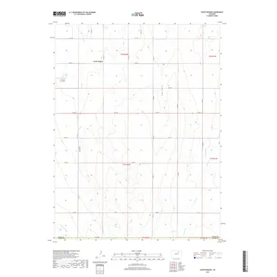
2019 Map of South Roggen
USGS Topo · Published 2019About this map
The agrarian landscape of South Roggen occupies this corner of Weld County, characterized by a structured grid of rural roads and ephemeral watercourses. Seasonal drainages such as Lost Cr and Hay Gulch weave between the rolling contours of the Colorado plains, while the presence of the Henrylyn Canal in the southwestern corner highlights the critical role of irrigation in this semi-arid region. The map also records the Air Dusters Inc Airport, a specialized aviation facility serving the local agricultural industry. Further south, the terrain descends toward the beds of Kiowa Cr and Comanche Cr, where the boundary between Weld and Adams counties is marked. This 2019 survey documents a landscape where traditional Section Line roads, including Co RD 12 and Co RD 85, provide the primary framework for the scattered farmsteads and open ranges of the High Plains.
Find a feature on this map
31 named features on this map. Tap any name to fly to it.
Don’t see what you’re looking for? This feature index may not catch every label — zoom into the map to look around manually.
Map Details
Editions of this 2019 South Roggen Map
This is the sole edition of this map. No revisions or reprints were ever made.
Other maps of this area

1949 · Sunnydale
USGS Topo · 1:24,000

1950 · South Roggen
USGS Topo · 1:24,000

1950 · Wiggins SW
USGS Topo · 1:24,000

1950 · Tampa
USGS Topo · 1:24,000

1950 · Prospect Valley
USGS Topo · 1:24,000

1951 · Prospect Valley
USGS Topo · 1:24,000

1951 · Living Springs
USGS Topo · 1:24,000

1951 · Roggen
USGS Topo · 1:24,000

1951 · Leader NW
USGS Topo · 1:24,000

1951 · Omar
USGS Topo · 1:24,000