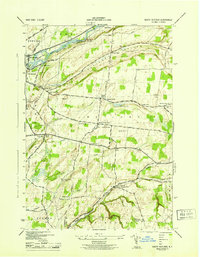
1943 Map of South Rutland
USGS Topo · Published 1954About this map
Watertown and its immediate eastern outskirts dominate the northwest corner of this Jefferson County landscape, where the Black River flows past Huntington Island and Delano Island. The interior transitions into a rolling agricultural and upland region defined by the town of Rutland and the drainage of Sandy Creek. A dense network of one-room schoolhouses, including School No 2 through School No 10, suggests a distributed rural population during the early 1940s. Transportation relies on the New York Central Railroad corridor and historic thoroughfares like State Street and Middle Road. Notable community centers such as Tylerville South Rutland and Burrs Mills anchor the southern half of the sheet, while family-named landmarks like Woodwards Side Hill and Orvis Hill provide specific geographical context for local historians.
Find a feature on this map
54 named features on this map. Tap any name to fly to it.
Don’t see what you’re looking for? This feature index may not catch every label — zoom into the map to look around manually.
Map Details
Editions of this 1943 South Rutland Map
2 editions found
Other maps of this area

1895 · Watertown
USGS Topo · 1:62,500

1898 · Watertown
USGS Topo · 1:62,500

1902 · Carthage
USGS Topo · 1:62,500

1903 · Theresa
USGS Topo · 1:62,500

1904 · Carthage
USGS Topo · 1:62,500

1908 · Watertown
USGS Topo · 1:62,500

1909 · Watertown
USGS Topo · 1:62,500

1911 · Antwerp
USGS Topo · 1:62,500

1942 · Copenhagen
USGS Topo · 1:24,000
1943 · Barnes Corners
USGS Topo · 1:31,680