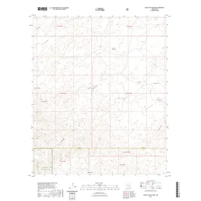
2023 Map of South Taylor Tank
USGS Topo · Published 2023About this map
Lincoln National Forest occupies the southwestern corner of this survey, marking the transition into protected high-desert woodlands. The landscape is defined by a complex network of dry drainage systems, including Bear Canyon and Sargent Canyon, which carve through the high plains of Chaves and Otero counties. Water management in this arid environment is highlighted by cattle tanks and catchment points like South Taylor Tank and Holt Tank Draw. The area’s ranching character is reinforced by a sparse network of service routes such as Bronc Rd and Sargent Canyon Rd, which follow the natural contours of the draws and ridges. Local topography is further segmented by prominent features like Deer Canyon and Crooked Canyon, illustrating the erosional patterns typical of the New Mexico borderlands.
Find a feature on this map
23 named features on this map. Tap any name to fly to it.
Don’t see what you’re looking for? This feature index may not catch every label — zoom into the map to look around manually.
Map Details
Editions of this 2023 South Taylor Tank Map
This is the sole edition of this map. No revisions or reprints were ever made.
Other maps of this area

1943 · Texas Hill
USGS Topo · 1:62,500

1945 · Texas Hill
USGS Topo · 1:62,500

1954 · Carlsbad
USGS Topo · 1:250,000

1958 · Carlsbad
USGS Topo · 1:250,000

1963 · Panama Ranch
USGS Topo · 1:24,000

1965 · Lewis Peak NE
USGS Topo · 1:24,000

1965 · Bullis Spring Ranch
USGS Topo · 1:24,000

1978 · Strychnine Draw
USGS Topo · 1:24,000

1978 · Encino Draw
USGS Topo · 1:24,000

1978 · Artesia
USGS Topo · 1:100,000