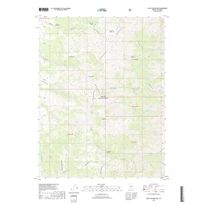
2018 Map of South Toiyabe Peak
USGS Topo · Published 2018About this map
Toiyabe National Forest surrounds the high elevations of the central Nevada ranges, where vertical drainages like Ophir Canyon and Marysville Canyon carve deep paths through the terrain. The map documents a landscape defined by seasonal grazing and historical extraction, evidenced by the Mohawk Pasture in the north and the Hamlin Mine perched on a western ridge. Water management and livestock history are central to this area, with the Werdenhoff Pasture situated near the headwaters of the N Twin River. This 2018 survey also highlights an extensive recreational network, including the Toiyabe Crest Natl Rec Trail which follows the high ridgelines. Connectivity between the deep canyons is maintained by primitive routes like Ophir Ridge Road and the Twin Rivers Loop, illustrating how modern recreation overlays older patterns of land use in Nye County.
Find a feature on this map
39 named features on this map. Tap any name to fly to it.
Don’t see what you’re looking for? This feature index may not catch every label — zoom into the map to look around manually.
Map Details
Editions of this 2018 South Toiyabe Peak Map
This is the sole edition of this map. No revisions or reprints were ever made.
Other maps of this area

1907 · Tonopah
USGS Topo · 1:250,000

1908 · Tonopah
USGS Topo · 1:250,000

1955 · Millett
USGS Topo · 1:250,000

1956 · North Shoshone Peak
USGS Topo · 1:62,500

1956 · Millett Ranch
USGS Topo · 1:62,500

1956 · Tonopah
USGS Topo · 1:250,000

1959 · Tonopah
USGS Topo · 1:250,000

1959 · Millett
USGS Topo · 1:250,000

1962 · Tonopah
USGS Topo · 1:250,000

1971 · Carvers NW
USGS Topo · 1:24,000