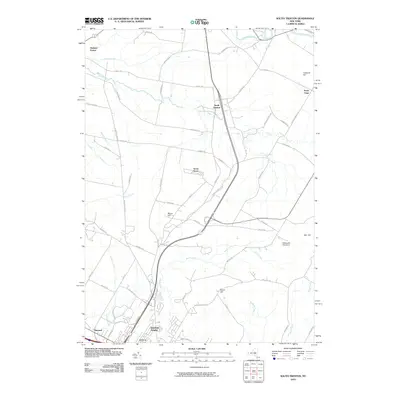
2010 Map of South Trenton
USGS Topo · Published 2010About this map
Ninemile Creek and Reall Creek define the drainage of this Oneida County landscape, where the northern edges of Utica meet the rural uplands of central New York. The 2010 topography shows a transition from the suburban clusters of Maynard and Deerfield Heights to the scattered dairy-country settlements of South Trenton and North Gage. Local history is embedded in the road names, reflecting early industry and agriculture with routes like Cheese Factory Rd, Glass Factory Rd, and Round Barn Rd.
Find a feature on this map
65 named features on this map. Tap any name to fly to it.
Don’t see what you’re looking for? This feature index may not catch every label — zoom into the map to look around manually.
Map Details
Editions of this 2010 South Trenton Map
This is the sole edition of this map. No revisions or reprints were ever made.
Other maps of this area

1895 · Oriskany
USGS Topo · 1:62,500

1897 · Remsen
USGS Topo · 1:62,500

1898 · Utica
USGS Topo · 1:62,500

1898 · Oriskany
USGS Topo · 1:62,500

1900 · Utica
USGS Topo · 1:62,500

1900 · Remsen
USGS Topo · 1:62,500

1904 · Boonville
USGS Topo · 1:62,500

1943 · Newport
USGS Topo · 1:24,000

1943 · Utica East
USGS Topo · 1:24,000
1943 · Ilion
USGS Topo · 1:24,000