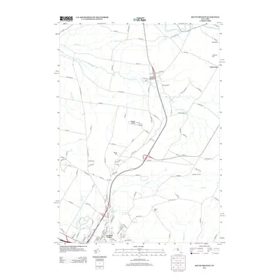
2013 Map of South Trenton
USGS Topo · Published 2013About this map
South Trenton and North Gage anchor the upper reaches of this Oneida County landscape, where the terrain transitions from the rolling slopes of Cameron Hill and Marcy Hill down toward the Mohawk Valley. The mapping reveals a distinct hydrological network feeding south and west, with Ninemile Cr, Beaver Cr, and Reall Cr carving drainage patterns through the farmland. In the south, the suburban expansion of Deerfield Heights is evident, situated just above the Utica Reservoir, which serves as a significant local landmark. Genealogists and local historians can find interest in the location of Salem Cem along Church Rd, while the distribution of rural landmarks like Atanasoffs Tree Farm and the aptly named Cheese Factory Rd preserves clues to the area’s agricultural and industrial heritage.
Find a feature on this map
117 named features on this map. Tap any name to fly to it.
Don’t see what you’re looking for? This feature index may not catch every label — zoom into the map to look around manually.
Map Details
Editions of this 2013 South Trenton Map
This is the sole edition of this map. No revisions or reprints were ever made.
Other maps of this area

1895 · Oriskany
USGS Topo · 1:62,500

1897 · Remsen
USGS Topo · 1:62,500

1898 · Utica
USGS Topo · 1:62,500

1898 · Oriskany
USGS Topo · 1:62,500

1900 · Utica
USGS Topo · 1:62,500

1900 · Remsen
USGS Topo · 1:62,500

1904 · Boonville
USGS Topo · 1:62,500

1943 · Newport
USGS Topo · 1:24,000

1943 · Utica East
USGS Topo · 1:24,000
1943 · Ilion
USGS Topo · 1:24,000