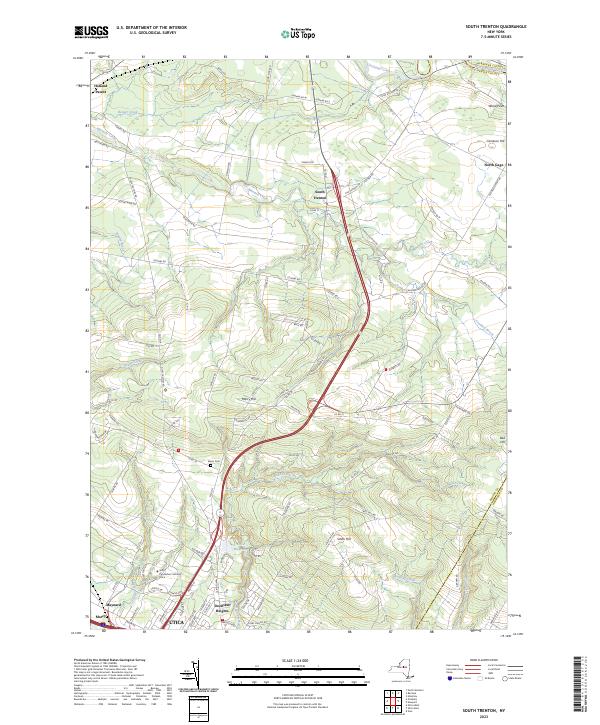
2023 Map of South Trenton
USGS Topo · Published 2023About this map
South Trenton and its surrounding uplands sit at a geographic crossroads where the Mohawk Valley meets the foothills of the Adirondacks. This northern fringe of Utica reveals a landscape defined by sharp elevation changes, as evidenced by the prominence of Marcy Hill, Smith Hill, and Bell Hill. The northern reach of the city is anchored by the SUNY Polytechnic Institute Utica campus and the neighboring community of Deerfield Heights, while the Utica Reservoir provides a critical infrastructure link between the developed valley and the rural hills above.
Find a feature on this map
102 named features on this map. Tap any name to fly to it.
Don’t see what you’re looking for? This feature index may not catch every label — zoom into the map to look around manually.
Map Details
Editions of this 2023 South Trenton Map
This is the sole edition of this map. No revisions or reprints were ever made.
Other maps of this area

1895 · Oriskany
USGS Topo · 1:62,500

1897 · Remsen
USGS Topo · 1:62,500

1898 · Utica
USGS Topo · 1:62,500

1898 · Oriskany
USGS Topo · 1:62,500

1900 · Utica
USGS Topo · 1:62,500

1900 · Remsen
USGS Topo · 1:62,500

1904 · Boonville
USGS Topo · 1:62,500

1943 · Newport
USGS Topo · 1:24,000

1943 · Utica East
USGS Topo · 1:24,000
1943 · Ilion
USGS Topo · 1:24,000