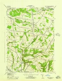
1945 Map of South Trenton
USGS Topo · Published 1945About this map
South Trenton serves as a central hub in this mid-1940s landscape, where the rural character of northern Oneida County is defined by its early infrastructure and scattered educational sites. The map documents a network of local schools, from School No 10 in the northeast to School No 7 near the western boundary, illustrating the distribution of the population before post-war consolidation. The terrain is marked by significant elevations like Marcy Hill and Bell Hill, with the Utica Reservoir providing a critical water source for the nearby city to the south.
Find a feature on this map
47 named features on this map. Tap any name to fly to it.
Don’t see what you’re looking for? This feature index may not catch every label — zoom into the map to look around manually.
Map Details
Editions of this 1945 South Trenton Map
This is the sole edition of this map. No revisions or reprints were ever made.
Other maps of this area

1895 · Oriskany
USGS Topo · 1:62,500

1897 · Remsen
USGS Topo · 1:62,500

1898 · Utica
USGS Topo · 1:62,500

1898 · Oriskany
USGS Topo · 1:62,500

1900 · Utica
USGS Topo · 1:62,500

1900 · Remsen
USGS Topo · 1:62,500

1904 · Boonville
USGS Topo · 1:62,500

1943 · Newport
USGS Topo · 1:24,000

1943 · Utica East
USGS Topo · 1:24,000
1943 · Ilion
USGS Topo · 1:24,000