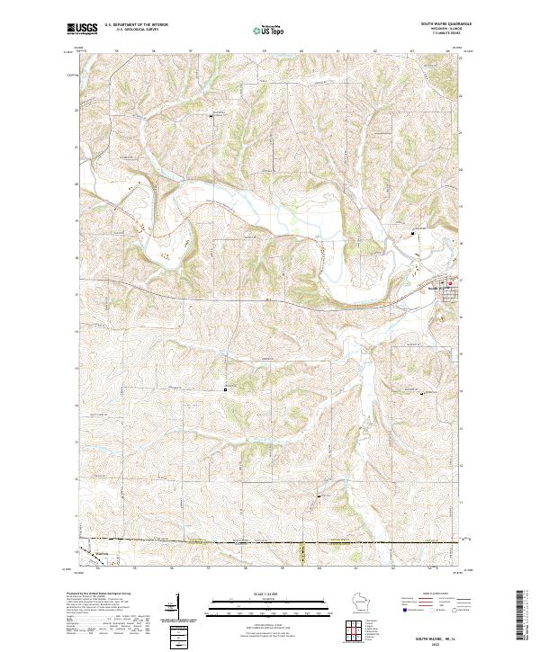
2022 Map of South Wayne
USGS Topo · Published 2022About this map
The Pecatonica River winds through this rural landscape at the border of Wisconsin and Illinois, anchoring a region of rolling farmland and creeks. The village of South Wayne sits near the river's path, while the town of Warren lies at the southern edge of the sheet across the state line. Genealogists will find a significant distribution of family and community burial grounds, including the West Wiota Lutheran Cem, Hoffman Cem, Brown Cem, Eastman Cem, and Zion Cem. A notable modern feature is the Cheese Country Recreation Trl, which follows the former rail grade through the river valley, reflecting the transition from an industrial transport corridor to a recreational path. Numerous watercourses like Spafford Cr and Turtle Cr define the local topography, marking the drainage patterns of Lafayette and Jo Daviess counties.
Find a feature on this map
67 named features on this map. Tap any name to fly to it.
Don’t see what you’re looking for? This feature index may not catch every label — zoom into the map to look around manually.
Map Details
Editions of this 2022 South Wayne Map
This is the sole edition of this map. No revisions or reprints were ever made.
Other maps of this area

1902 · Mineral Point
USGS Topo · 1:125,000

1911 · Elizabeth
USGS Topo · 1:62,500

1923 · South Wayne
USGS Topo · 1:62,500

1936 · Elizabeth
USGS Topo · 1:62,500

1937 · Lena
USGS Topo · 1:48,000

1942 · Lena
USGS Topo · 1:62,500

1943 · Lena
USGS Topo · 1:62,500

1954 · Rockford
USGS Topo · 1:250,000

1955 · Rockford
USGS Topo · 1:250,000

1958 · Rockford
USGS Topo · 1:250,000