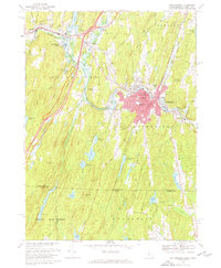
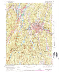
1967 Map of Southbridge
USGS Topo · Published 1967About this map
The Quinebaug River winds through this New England landscape, anchoring the industrial and cultural hub of Southbridge. The town center is densely detailed, showing the Southbridge High School, the Harrington Memorial Hospital, and several parish sites including St Marys Cemetery and St Hedwigs Cemetery. To the west, the living history museum at Old Sturbridge Village is established near the river, complete with its Covered Bridges.
Find a feature on this map
79 named features on this map. Tap any name to fly to it.
Don’t see what you’re looking for? This feature index may not catch every label — zoom into the map to look around manually.
Map Details
Editions of this 1967 Southbridge Map
6 editions found
Historical Maps of Southbridge Through Time
305 maps found

1886 Blackstone
Worcester County, MA

1887 Barre
Worcester County, MA

1887 Brookfield
Worcester County, MA

1887 Marlboro
Worcester County, MA

1887 Winchendon
Worcester County, MA

1889 Barre
Worcester County, MA

1889 Blackstone
Worcester County, MA

1889 Marlboro
Worcester County, MA

1889 Webster
Worcester County, MA

1890 Brookfield
Worcester County, MA

1890 Winchendon
Worcester County, MA

1892 Webster
Worcester County, MA

1893 Blackstone
Worcester County, MA

1893 Brookfield
Worcester County, MA

1894 Barre
Worcester County, MA

1894 Winchendon
Worcester County, MA

1896 Marlboro
Worcester County, MA

1898 Marlboro
Worcester County, MA

1900 Blackstone
Worcester County, MA

1908 Quinsigamond
Worcester County, MA

1908 Ware
Worcester County, MA

1915 Brookfield
Worcester County, MA

1919 Blackstone
Worcester County, MA

1921 Brookfield
Worcester County, MA

1921 Webster
Worcester County, MA

1932 Winchendon
Worcester County, MA

1935 Millbury
Worcester County, MA

1935 Shirley
Worcester County, MA

1935 Winchendon
Worcester County, MA

1937 Leicester
Worcester County, MA

1937 Paxton
Worcester County, MA

1939 Shirley
Worcester County, MA

1939 Wachusett Mtn
Worcester County, MA

1939 Worcester North
Worcester County, MA

1939 Worcester South
Worcester County, MA

1940 Sterling
Worcester County, MA

1940 Wachusett Mtn
Worcester County, MA

1941 Leicester
Worcester County, MA

1941 Paxton
Worcester County, MA

1942 Sterling
Worcester County, MA

1942 Wachusett Mtn.
Worcester County, MA

1942 Ware
Worcester County, MA

1943 Brookfield
Worcester County, MA

1943 Clinton
Worcester County, MA

1943 Marlboro
Worcester County, MA

1943 Quinsigamond
Worcester County, MA

1943 Shrewsbury
Worcester County, MA

1944 Blackstone
Worcester County, MA

1944 Grafton
Worcester County, MA

1944 Uxbridge
Worcester County, MA

1945 Southbridge
Worcester County, MA

1945 Webster
Worcester County, MA

1946 Ashburnham
Worcester County, MA

1946 Athol
Worcester County, MA

1946 Barre
Worcester County, MA

1946 East Brookfield
Worcester County, MA

1946 Milford
Worcester County, MA

1946 North Brookfield
Worcester County, MA

1946 Oxford
Worcester County, MA

1946 Petersham
Worcester County, MA

1946 Royalston
Worcester County, MA

1946 Sterling
Worcester County, MA

1946 Templeton
Worcester County, MA

1946 Wachusett Mtn
Worcester County, MA

1946 Ware
Worcester County, MA

1946 Warren
Worcester County, MA

1946 Winchendon
Worcester County, MA

1948 Blackstone
Worcester County, MA

1948 Worcester North
Worcester County, MA

1948 Worcester South
Worcester County, MA

1949 Shirley
Worcester County, MA

1950 Ashburnham
Worcester County, MA

1950 Clinton
Worcester County, MA

1950 Paxton
Worcester County, MA

1950 Shirley
Worcester County, MA

1950 Sterling
Worcester County, MA

1952 North Brookfield
Worcester County, MA

1952 Southbridge
Worcester County, MA

1953 Blackstone
Worcester County, MA

1953 Grafton
Worcester County, MA

1953 Leicester
Worcester County, MA

1953 Marlboro
Worcester County, MA

1953 Milford
Worcester County, MA

1953 Oxford
Worcester County, MA

1953 Shrewsbury
Worcester County, MA

1953 Uxbridge
Worcester County, MA

1953 Webster
Worcester County, MA

1954 Athol
Worcester County, MA

1954 Barre
Worcester County, MA

1954 East Brookfield
Worcester County, MA

1954 Petersham
Worcester County, MA

1954 Royalston
Worcester County, MA

1954 Templeton
Worcester County, MA

1954 Ware
Worcester County, MA

1954 Warren
Worcester County, MA

1954 Winchendon
Worcester County, MA

1955 Shirley
Worcester County, MA

1956 Wachusett Mtn
Worcester County, MA

1960 Worcester North
Worcester County, MA

1960 Worcester South
Worcester County, MA

1964 Oxford
Worcester County, MA

1965 Ashburnham
Worcester County, MA

1965 Clinton
Worcester County, MA

1965 Paxton
Worcester County, MA

1965 Shirley
Worcester County, MA

1967 North Brookfield
Worcester County, MA

1967 Southbridge
Worcester County, MA

1968 Milford
Worcester County, MA

1968 Sterling
Worcester County, MA

1969 Barre
Worcester County, MA

1969 Blackstone
Worcester County, MA

1969 East Brookfield
Worcester County, MA

1969 Grafton
Worcester County, MA

1969 Leicester
Worcester County, MA

1969 Oxford
Worcester County, MA

1969 Petersham
Worcester County, MA

1969 Shrewsbury
Worcester County, MA

1969 Uxbridge
Worcester County, MA

1969 Ware
Worcester County, MA

1969 Warren
Worcester County, MA

1969 Webster
Worcester County, MA

1970 Athol
Worcester County, MA

1970 Templeton
Worcester County, MA

1971 Royalston
Worcester County, MA

1971 Winchendon
Worcester County, MA

1972 Wachusett Mtn
Worcester County, MA

1973 Worcester South
Worcester County, MA

1974 Worcester North
Worcester County, MA

1975 Ashburnham
Worcester County, MA

1975 Athol
Worcester County, MA

1975 Barre
Worcester County, MA

1975 Clinton
Worcester County, MA

1975 East Brookfield
Worcester County, MA

1975 Grafton
Worcester County, MA

1975 Leicester
Worcester County, MA

1975 North Brookfield
Worcester County, MA

1975 Oxford
Worcester County, MA

1975 Paxton
Worcester County, MA

1975 Petersham
Worcester County, MA

1975 Royalston
Worcester County, MA

1975 Shirley
Worcester County, MA

1975 Shrewsbury
Worcester County, MA

1975 Southbridge
Worcester County, MA

1975 Sterling
Worcester County, MA

1975 Templeton
Worcester County, MA

1975 Uxbridge
Worcester County, MA

1975 Wachusett Mtn.
Worcester County, MA

1975 Ware
Worcester County, MA

1975 Warren
Worcester County, MA

1975 Webster
Worcester County, MA

1975 Winchendon
Worcester County, MA

1975 Worcester North
Worcester County, MA

1975 Worcester South
Worcester County, MA

1977 Blackstone
Worcester County, MA

1977 Milford
Worcester County, MA

1982 Milford
Worcester County, MA

1982 North Brookfield
Worcester County, MA

1982 Southbridge
Worcester County, MA

1982 Uxbridge
Worcester County, MA

1982 Warren
Worcester County, MA

1982 Webster
Worcester County, MA

1983 Worcester North
Worcester County, MA

1983 Worcester South
Worcester County, MA

1988 Ashburnham
Worcester County, MA

1988 Athol
Worcester County, MA

1988 Barre
Worcester County, MA

1988 Hudson
Worcester County, MA

1988 Sterling
Worcester County, MA

1988 Winchendon
Worcester County, MA

1997 Hudson
Worcester County, MA

2012 Ashburnham
Worcester County, MA

2012 Athol
Worcester County, MA

2012 Barre
Worcester County, MA

2012 Blackstone
Worcester County, MA

2012 Clinton
Worcester County, MA

2012 East Brookfield
Worcester County, MA

2012 Grafton
Worcester County, MA

2012 Leicester
Worcester County, MA

2012 Milford
Worcester County, MA

2012 North Brookfield
Worcester County, MA

2012 Oxford
Worcester County, MA

2012 Paxton
Worcester County, MA

2012 Petersham
Worcester County, MA

2012 Royalston
Worcester County, MA

2012 Shirley
Worcester County, MA

2012 Shrewsbury
Worcester County, MA

2012 Southbridge
Worcester County, MA

2012 Sterling
Worcester County, MA

2012 Templeton
Worcester County, MA

2012 Uxbridge
Worcester County, MA

2012 Wachusett Mountain
Worcester County, MA

2012 Ware
Worcester County, MA

2012 Warren
Worcester County, MA

2012 Webster
Worcester County, MA

2012 Winchendon
Worcester County, MA

2012 Worcester North
Worcester County, MA

2012 Worcester South
Worcester County, MA

2015 Ashburnham
Worcester County, MA

2015 Athol
Worcester County, MA

2015 Barre
Worcester County, MA

2015 Blackstone
Worcester County, MA

2015 Clinton
Worcester County, MA

2015 East Brookfield
Worcester County, MA

2015 Grafton
Worcester County, MA

2015 Leicester
Worcester County, MA

2015 Milford
Worcester County, MA

2015 North Brookfield
Worcester County, MA

2015 Oxford
Worcester County, MA

2015 Paxton
Worcester County, MA

2015 Petersham
Worcester County, MA

2015 Royalston
Worcester County, MA

2015 Shirley
Worcester County, MA

2015 Shrewsbury
Worcester County, MA

2015 Southbridge
Worcester County, MA

2015 Sterling
Worcester County, MA

2015 Templeton
Worcester County, MA

2015 Uxbridge
Worcester County, MA

2015 Wachusett Mountain
Worcester County, MA

2015 Ware
Worcester County, MA

2015 Warren
Worcester County, MA

2015 Webster
Worcester County, MA

2015 Winchendon
Worcester County, MA

2015 Worcester North
Worcester County, MA

2015 Worcester South
Worcester County, MA

2018 Ashburnham
Worcester County, MA

2018 Athol
Worcester County, MA

2018 Barre
Worcester County, MA

2018 Blackstone
Worcester County, MA

2018 Clinton
Worcester County, MA

2018 East Brookfield
Worcester County, MA

2018 Grafton
Worcester County, MA

2018 Leicester
Worcester County, MA

2018 Milford
Worcester County, MA

2018 North Brookfield
Worcester County, MA

2018 Oxford
Worcester County, MA

2018 Paxton
Worcester County, MA

2018 Petersham
Worcester County, MA

2018 Royalston
Worcester County, MA

2018 Shirley
Worcester County, MA

2018 Shrewsbury
Worcester County, MA

2018 Southbridge
Worcester County, MA

2018 Sterling
Worcester County, MA

2018 Templeton
Worcester County, MA

2018 Uxbridge
Worcester County, MA

2018 Wachusett Mountain
Worcester County, MA

2018 Ware
Worcester County, MA

2018 Warren
Worcester County, MA

2018 Webster
Worcester County, MA

2018 Winchendon
Worcester County, MA

2018 Worcester North
Worcester County, MA

2018 Worcester South
Worcester County, MA

2021 Ashburnham
Worcester County, MA

2021 Athol
Worcester County, MA

2021 Barre
Worcester County, MA

2021 Blackstone
Worcester County, MA

2021 Clinton
Worcester County, MA

2021 East Brookfield
Worcester County, MA

2021 Grafton
Worcester County, MA

2021 Leicester
Worcester County, MA

2021 Milford
Worcester County, MA

2021 North Brookfield
Worcester County, MA

2021 Oxford
Worcester County, MA

2021 Paxton
Worcester County, MA

2021 Petersham
Worcester County, MA

2021 Royalston
Worcester County, MA

2021 Shirley
Worcester County, MA

2021 Shrewsbury
Worcester County, MA

2021 Southbridge
Worcester County, MA

2021 Sterling
Worcester County, MA

2021 Templeton
Worcester County, MA

2021 Uxbridge
Worcester County, MA

2021 Wachusett Mountain
Worcester County, MA

2021 Ware
Worcester County, MA

2021 Warren
Worcester County, MA

2021 Webster
Worcester County, MA

2021 Winchendon
Worcester County, MA

2021 Worcester North
Worcester County, MA

2021 Worcester South
Worcester County, MA

2024 Ashburnham
Worcester County, MA

2024 Athol
Worcester County, MA

2024 Barre
Worcester County, MA

2024 Blackstone
Worcester County, MA

2024 Clinton
Worcester County, MA

2024 East Brookfield
Worcester County, MA

2024 Grafton
Worcester County, MA

2024 Leicester
Worcester County, MA

2024 Milford
Worcester County, MA

2024 North Brookfield
Worcester County, MA

2024 Oxford
Worcester County, MA

2024 Paxton
Worcester County, MA

2024 Petersham
Worcester County, MA

2024 Royalston
Worcester County, MA

2024 Shirley
Worcester County, MA

2024 Shrewsbury
Worcester County, MA

2024 Southbridge
Worcester County, MA

2024 Sterling
Worcester County, MA

2024 Templeton
Worcester County, MA

2024 Uxbridge
Worcester County, MA

2024 Wachusett Mountain
Worcester County, MA

2024 Ware
Worcester County, MA

2024 Warren
Worcester County, MA

2024 Webster
Worcester County, MA

2024 Winchendon
Worcester County, MA

2024 Worcester North
Worcester County, MA

2024 Worcester South
Worcester County, MA