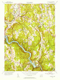
1953 Map of Southbury
USGS Topo · Published 1956About this map
The Housatonic River and the expansive Lake Zoar dominate this mid-century landscape at the boundary of Fairfield and New Haven counties. The terrain is defined by family-named heights such as Georges Hill and Osborn Hill, with the residential pockets of Cedarhurst and Lakeside clinging to the shoreline. Near the northern reaches, the Pomperaug River winds through South Britain, where the South Britain Consolidated Sch serves as a local landmark alongside Pine Hill Cem.
Find a feature on this map
57 named features on this map. Tap any name to fly to it.
Don’t see what you’re looking for? This feature index may not catch every label — zoom into the map to look around manually.
Map Details
Editions of this 1953 Southbury Map
3 editions found
Other maps of this area

1889 · Derby
USGS Topo · 1:62,500

1891 · Derby
USGS Topo · 1:62,500

1892 · Danbury
USGS Topo · 1:62,500

1892 · New Milford
USGS Topo · 1:62,500

1893 · Waterbury
USGS Topo · 1:62,500

1893 · New Milford
USGS Topo · 1:62,500

1893 · Derby
USGS Topo · 1:62,500

1904 · New Milford
USGS Topo · 1:62,500

1904 · Waterbury
USGS Topo · 1:62,500

1904 · Litchfield
USGS Topo · 1:125,000