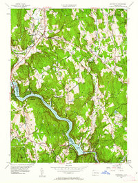
1953 Map of Southbury
USGS Topo · Published 1962About this map
The Housatonic River forms a wide, dramatic bend through this mid-century landscape, widening into Lake Zoar near the settlement of Stevenson. Along its eastern banks, the preserved lands of Kettletown State Park and Pugwegut State Forest showcase the area's transition from agricultural use to recreational conservation. This era of mapping documents the established communities of Southbury and Southford, where the landscape is peppered with family-named landmarks like Walnut Hill and Bowers Hill.
Find a feature on this map
72 named features on this map. Tap any name to fly to it.
Don’t see what you’re looking for? This feature index may not catch every label — zoom into the map to look around manually.
Map Details
Editions of this 1953 Southbury Map
3 editions found
Other maps of this area

1889 · Derby
USGS Topo · 1:62,500

1891 · Derby
USGS Topo · 1:62,500

1892 · Danbury
USGS Topo · 1:62,500

1892 · New Milford
USGS Topo · 1:62,500

1893 · Waterbury
USGS Topo · 1:62,500

1893 · New Milford
USGS Topo · 1:62,500

1893 · Derby
USGS Topo · 1:62,500

1904 · New Milford
USGS Topo · 1:62,500

1904 · Waterbury
USGS Topo · 1:62,500

1904 · Litchfield
USGS Topo · 1:125,000