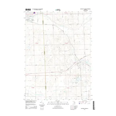
2014 Map of Southeast Albion
USGS Topo · Published 2014About this map
The North Branch Kalamazoo River winds through this landscape on the border of Calhoun Co and Jackson Co, connecting the institutional grounds of Albion Coll in the northwest to the village of Concord. This survey captures a rural Michigan geography defined by its water and agricultural heritage, where the river and the Spring Arbor and Concord Drain intersect with a grid of country roads like Albion Rd and Homer Rd. For those tracing local history, several burial grounds are scattered across the townships, including Bayn Cem, Woodliff Cem, and Maple Grove Cem. The southern half of the sheet reveals a cluster of glacial lakes, including Swains Lake, Gregory Lake, and Bartelle Lake, which contrast with the more structured settlement patterns in the north. The presence of the North Country National Scenic Trail near Albion marks the modern utility of this historical river corridor.
Find a feature on this map
79 named features on this map. Tap any name to fly to it.
Don’t see what you’re looking for? This feature index may not catch every label — zoom into the map to look around manually.
Map Details
Editions of this 2014 Southeast Albion Map
This is the sole edition of this map. No revisions or reprints were ever made.
Other maps of this area

1919 · Springport
USGS Topo · 1:62,500

1921 · Springport
USGS Topo · 1:62,500

1921 · Marshall
USGS Topo · 1:62,500

1923 · Marshall
USGS Topo · 1:62,500

1943 · Marshall
USGS Topo · 1:62,500

1948 · Spring Arbor
USGS Topo · 1:62,500

1948 · Homer
USGS Topo · 1:62,500

1949 · Homer
USGS Topo · 1:62,500

1949 · Spring Arbor
USGS Topo · 1:62,500

1958 · Grand Rapids
USGS Topo · 1:250,000