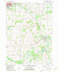
1981 Map of Southeast Albion
USGS Topo · Published 1981About this map
The Kalamazoo River and its various branches dominate the landscape between Albion and Concord, defining the drainage patterns and historical development of this border region between Calhoun and Jackson counties. To the northeast, the North Branch Kalamazoo River flows through a series of gravel pits and low-lying areas, while the Conrail line parallels its path, connecting the major settlements. Significant water features like Swains Lake and Mill Pond highlight the recreational and industrial use of the local waterways, with Swains Lake County Park and a nearby boat ramp serving as community hubs.
Find a feature on this map
40 named features on this map. Tap any name to fly to it.
Don’t see what you’re looking for? This feature index may not catch every label — zoom into the map to look around manually.
Map Details
Editions of this 1981 Southeast Albion Map
This is the sole edition of this map. No revisions or reprints were ever made.
Other maps of this area

1919 · Springport
USGS Topo · 1:62,500

1921 · Springport
USGS Topo · 1:62,500

1921 · Marshall
USGS Topo · 1:62,500

1923 · Marshall
USGS Topo · 1:62,500

1943 · Marshall
USGS Topo · 1:62,500

1948 · Spring Arbor
USGS Topo · 1:62,500

1948 · Homer
USGS Topo · 1:62,500

1949 · Homer
USGS Topo · 1:62,500

1949 · Spring Arbor
USGS Topo · 1:62,500

1958 · Grand Rapids
USGS Topo · 1:250,000