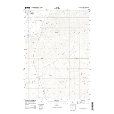
2013 Map of Southeast Emmett
USGS Topo · Published 2013About this map
Emmett serves as the focal point for this survey of the irrigated valley and upland desert south of the Payette River. The landscape is defined by the vital water infrastructure supporting regional agriculture, notably the Black Canyon Canal and the Last Chance Canal, which contour through the northern half of the sheet. Rising south of the town, Freezeout Hill provides a dramatic change in elevation, marking the transition from the flatlands of the valley to the dissected ridges and gulches that characterize the interior of the quadrangle.
Find a feature on this map
53 named features on this map. Tap any name to fly to it.
Don’t see what you’re looking for? This feature index may not catch every label — zoom into the map to look around manually.
Map Details
Editions of this 2013 Southeast Emmett Map
This is the sole edition of this map. No revisions or reprints were ever made.
Other maps of this area

1892 · Boise
USGS Topo · 1:125,000

1897 · Boise
USGS Topo · 1:125,000

1898 · Nampa
USGS Topo · 1:125,000

1953 · Eagle
USGS Topo · 1:24,000

1953 · Star
USGS Topo · 1:24,000

1953 · Montour
USGS Topo · 1:62,500

1955 · Boise
USGS Topo · 1:250,000

1958 · Boise
USGS Topo · 1:250,000
1958 · Middleton
USGS Topo · 1:24,000

1962 · Boise
USGS Topo · 1:250,000