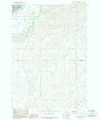
1985 Map of Southeast Emmett
USGS Topo · Published 1986About this map
Emmett Valley serves as the focal point for this mid-1980s survey, where the town of Emmett transitions into the dissected uplands of Gem and Ada counties. The landscape is defined by its sophisticated irrigation infrastructure, notably the Black Canyon Canal and Last Chance Canal, which trace the contours above the valley floor to support local agriculture. Rising sharply to the south, Freezeout Hill provides a natural barrier overlooking the drainage of Sand Hollow Creek.
Find a feature on this map
15 named features on this map. Tap any name to fly to it.
Don’t see what you’re looking for? This feature index may not catch every label — zoom into the map to look around manually.
Map Details
Editions of this 1985 Southeast Emmett Map
This is the sole edition of this map. No revisions or reprints were ever made.
Other maps of this area

1892 · Boise
USGS Topo · 1:125,000

1897 · Boise
USGS Topo · 1:125,000

1898 · Nampa
USGS Topo · 1:125,000

1953 · Eagle
USGS Topo · 1:24,000

1953 · Star
USGS Topo · 1:24,000

1953 · Montour
USGS Topo · 1:62,500

1955 · Boise
USGS Topo · 1:250,000

1958 · Boise
USGS Topo · 1:250,000
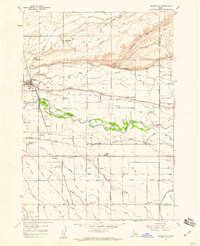
1958 · Middleton
USGS Topo · 1:24,000

1962 · Boise
USGS Topo · 1:250,000