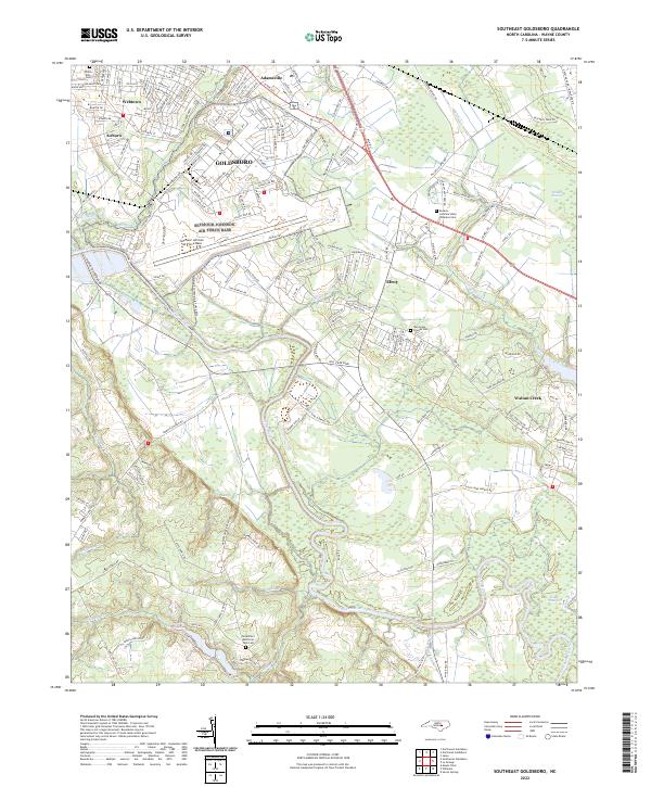
2022 Map of Southeast Goldsboro
USGS Topo · Published 2022About this map
Seymour Johnson Air Force Base dominates the central landscape of this Wayne County survey, situated just southeast of the city of Goldsboro. The map reveals the intricate urban and suburban expansion of neighborhoods like Webtown, Airboro, and Adamsville, which sit north of the airfield's expansive runways. To the south, the topography shifts toward the wetlands of the Neuse River basin, featuring the Walnut Pocosin and the dense marshlands of Bogue Marsh. Genealogists will find several significant burial sites, including the Willow Dale Cem and the Eastern Carolina State Veterans Cem. The drainage pattern is defined by numerous tributaries such as Fellows Br, Sleepy Cr, and Walnut Cr, which flow through a network of rural roads and established communities like Elroy.
Find a feature on this map
183 named features on this map. Tap any name to fly to it.
Don’t see what you’re looking for? This feature index may not catch every label — zoom into the map to look around manually.
Map Details
Editions of this 2022 Southeast Goldsboro Map
This is the sole edition of this map. No revisions or reprints were ever made.
Other maps of this area

1953 · Rocky Mount
USGS Topo · 1:250,000

1953 · Raleigh
USGS Topo · 1:250,000

1954 · Rocky Mount
USGS Topo · 1:250,000

1954 · Raleigh
USGS Topo · 1:250,000

1957 · Goldsboro
USGS Topo · 1:62,500

1957 · Seven Springs
USGS Topo · 1:62,500

1974 · Northwest Goldsboro
USGS Topo · 1:24,000

1974 · Southwest Goldsboro
USGS Topo · 1:24,000
1977 · Mount Olive
USGS Topo · 1:24,000

1980 · Seven Springs
USGS Topo · 1:24,000