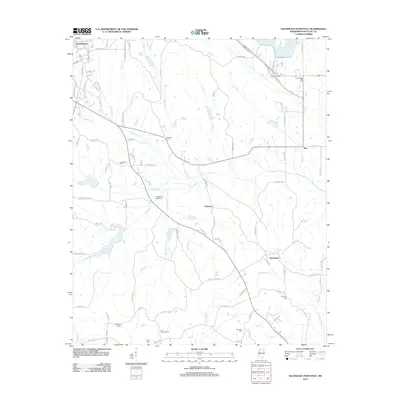
2012 Map of Southeast Pontotoc
USGS Topo · Published 2012About this map
The D'Artaguette Battlefield serves as a significant historical anchor in this portion of Pontotoc County, marking a landscape defined by small rural settlements and a dense network of creek drainages. Moving south from the outskirts of Pontotoc, the terrain is segmented by several watercourses including Naugher Cr, Chiwapa Cr, and Tallabinnela Cr. These creeks historically dictated the placement of early homesteads and cemeteries that dot the countryside today, such as Ebenezer Cem and College Hill Cem.
Find a feature on this map
102 named features on this map. Tap any name to fly to it.
Don’t see what you’re looking for? This feature index may not catch every label — zoom into the map to look around manually.
Map Details
Editions of this 2012 Southeast Pontotoc Map
This is the sole edition of this map. No revisions or reprints were ever made.
Other maps of this area

1949 · New Albany
USGS Topo · 1:62,500

1951 · New Albany
USGS Topo · 1:62,500

1955 · Sherman
USGS Topo · 1:62,500

1956 · Tupelo
USGS Topo · 1:250,000

1958 · Tupelo
USGS Topo · 1:250,000

1966 · Troy NW
USGS Topo · 1:24,000

1966 · Troy SE
USGS Topo · 1:24,000

1966 · Bissell
USGS Topo · 1:24,000

1966 · Troy
USGS Topo · 1:24,000

1972 · Houlka
USGS Topo · 1:24,000