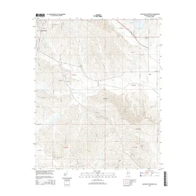
2015 Map of Southeast Pontotoc
USGS Topo · Published 2015About this map
Pontotoc serves as the focal point for this 2015 survey, which extends into the southeastern reaches of the county. The landscape is defined by the winding paths of Chiwapa Cr and Tallabinnela Cr, surrounded by a dense network of country roads and local connectors. This era shows a distinct pattern of small, established rural communities such as Chiwapa, Woodland, and Zion, many of which are anchored by long-standing landmarks and family names. Genealogists will find significant value in the distribution of several rural burial grounds, including Pleasant Grove Cem, Ebenezer Cem, and Smerney Cem. The transition from the urban grid of southeastern Pontotoc to the agrarian sections of t11s r4e illustrates the area's modern land use, where residential development meets the traditional drainage basins of Goodford Cr and Owl Cr.
Find a feature on this map
86 named features on this map. Tap any name to fly to it.
Don’t see what you’re looking for? This feature index may not catch every label — zoom into the map to look around manually.
Map Details
Editions of this 2015 Southeast Pontotoc Map
This is the sole edition of this map. No revisions or reprints were ever made.
Other maps of this area

1949 · New Albany
USGS Topo · 1:62,500

1951 · New Albany
USGS Topo · 1:62,500

1955 · Sherman
USGS Topo · 1:62,500

1956 · Tupelo
USGS Topo · 1:250,000

1958 · Tupelo
USGS Topo · 1:250,000

1966 · Troy NW
USGS Topo · 1:24,000

1966 · Troy SE
USGS Topo · 1:24,000

1966 · Bissell
USGS Topo · 1:24,000

1966 · Troy
USGS Topo · 1:24,000

1972 · Houlka
USGS Topo · 1:24,000