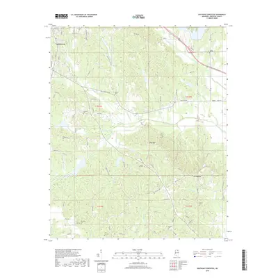
2018 Map of Southeast Pontotoc
USGS Topo · Published 2018About this map
Pontotoc anchors the northwestern corner of this landscape, where the street grid of the county seat transitions into the rolling creek valleys of the Mississippi hill country. The map detail follows the drainage patterns of Chiwapa Creek and its tributaries, including Calloway Cr and Goodford Cr, which carve through the rural terrain south of Zion. This area is marked by a high density of historic burial grounds, serving as a primary record for family researchers. From College Hill Cem in the northeast to McCluskey Cem and Ware Cem in the south, these sites indicate the locations of early rural communities. Smaller settlements like Chiwapa and Woodland are situated among a complex network of local roads such as Black Zion Rd and Rackley Loop, illustrating the persistent agricultural settlement patterns of Pontotoc County.
Find a feature on this map
84 named features on this map. Tap any name to fly to it.
Don’t see what you’re looking for? This feature index may not catch every label — zoom into the map to look around manually.
Map Details
Editions of this 2018 Southeast Pontotoc Map
This is the sole edition of this map. No revisions or reprints were ever made.
Other maps of this area

1949 · New Albany
USGS Topo · 1:62,500

1951 · New Albany
USGS Topo · 1:62,500

1955 · Sherman
USGS Topo · 1:62,500

1956 · Tupelo
USGS Topo · 1:250,000

1958 · Tupelo
USGS Topo · 1:250,000

1966 · Troy NW
USGS Topo · 1:24,000

1966 · Troy SE
USGS Topo · 1:24,000

1966 · Bissell
USGS Topo · 1:24,000

1966 · Troy
USGS Topo · 1:24,000

1972 · Houlka
USGS Topo · 1:24,000