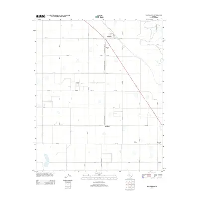
2012 Map of Southland
USGS Topo · Published 2012About this map
Southland serves as the primary community in this West Texas landscape, where a grid of rural routes like Co Road JJ and Co Rd-115 defines the territory. The map reveals a region driven by natural resource extraction and agriculture, evidenced by the Suniland Oil Field and the PHD Oil Field. These industrial features sit alongside local centers of life such as Hackberry and Pleasant Valley, providing a look at the dispersed settlement patterns of Garza County. The terrain is marked by seasonal watercourses, including N Dokegood Cr and S Dokegood Cr, which break up the geometric precision of the farm-to-market road system. Local heritage is anchored by sites like Resthaven Cem, situated just south of the main town site along Farm-to-Market Road 2106.
Find a feature on this map
40 named features on this map. Tap any name to fly to it.
Don’t see what you’re looking for? This feature index may not catch every label — zoom into the map to look around manually.
Map Details
Editions of this 2012 Southland Map
This is the sole edition of this map. No revisions or reprints were ever made.
Other maps of this area

1954 · Lubbock
USGS Topo · 1:250,000

1965 · Slaton
USGS Topo · 1:24,000

1965 · Southland
USGS Topo · 1:24,000

1965 · Wilson
USGS Topo · 1:24,000

1965 · Slaton NE
USGS Topo · 1:24,000

1966 · Cap Rock
USGS Topo · 1:24,000

1968 · South Dokegood Creek
USGS Topo · 1:24,000

1969 · Post West
USGS Topo · 1:24,000

1970 · New Lynn
USGS Topo · 1:24,000

1970 · Grassland
USGS Topo · 1:24,000