
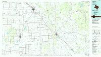
1968 Map of South Dokegood Creek
USGS Topo · Published 1971About this map
The Double Mountain Fork Brazos River carves through this West Texas landscape, where the local economy of the late 1960s is defined by petroleum extraction and rail transport. The H D Oil Field dominates the southwestern quadrant, marked by a dense concentration of wells, tanks, and a Radio Tower. This industrial activity is contrasted by the rural settlements of Buenos and Huntley, which sit along the established transport corridor of the Atchison Topeka and Santa Fe railroad.
Find a feature on this map
12 named features on this map. Tap any name to fly to it.
Don’t see what you’re looking for? This feature index may not catch every label — zoom into the map to look around manually.
Map Details
Editions of this 1968 South Dokegood Creek Map
This is the sole edition of this map. No revisions or reprints were ever made.
Other maps of this area

1954 · Lubbock
USGS Topo · 1:250,000

1965 · Southland
USGS Topo · 1:24,000

1965 · Slaton NE
USGS Topo · 1:24,000

1966 · Cap Rock
USGS Topo · 1:24,000

1966 · Canyon Valley
USGS Topo · 1:24,000

1969 · Cap Rock SE
USGS Topo · 1:24,000

1969 · Post East
USGS Topo · 1:24,000

1969 · Post West
USGS Topo · 1:24,000

1970 · Grassland
USGS Topo · 1:24,000
1986 · Slaton
USGS Topo · 1:100,000