
1965 Map of Southland
USGS Topo · Published 1966About this map
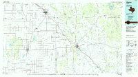
The high plains landscape of the Texas Panhandle is defined by industrial extraction and small settlements along the Atchison Topeka and Santa Fe railroad line. Centered on the boundary of Lynn and Garza counties, this mid-1960s survey documents a region dominated by the Suniland Oil Field and the P H D Oil Field, where numerous wells pockmark the terrain. The community of Southland serves as a local hub, featuring the nearby Resthaven Cem and several local quarries. To the east, the topography shifts abruptly at Red Hollow Can, providing a break in the otherwise steady elevation. Smaller locales such as Hackberry, Gordon, and Pleasant Valley are anchored by crossroads and scattered farmsteads, reflecting the rural settlement patterns typical of the Llano Estacado during this era of peak petroleum production.
Find a feature on this map
14 named features on this map. Tap any name to fly to it.
Don’t see what you’re looking for? This feature index may not catch every label — zoom into the map to look around manually.
Map Details
Editions of this 1965 Southland Map
This is the sole edition of this map. No revisions or reprints were ever made.
Other maps of this area

1954 · Lubbock
USGS Topo · 1:250,000

1965 · Slaton
USGS Topo · 1:24,000

1965 · Wilson
USGS Topo · 1:24,000

1965 · Slaton NE
USGS Topo · 1:24,000

1966 · Cap Rock
USGS Topo · 1:24,000

1968 · South Dokegood Creek
USGS Topo · 1:24,000

1969 · Post West
USGS Topo · 1:24,000

1970 · New Lynn
USGS Topo · 1:24,000

1970 · Grassland
USGS Topo · 1:24,000
1986 · Slaton
USGS Topo · 1:100,000