
1965 Map of Wilson
USGS Topo · Published 1966About this map
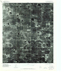
The town of Wilson anchors this mid-century survey of the High Plains, where the Atchison Topeka and Santa Fe railroad line cuts a straight diagonal through a landscape defined by depressions and intermittent basins. To the southwest, the expansive Tahoka Lake and the smaller Hidden Lake provide significant topographic relief in an area otherwise dominated by agriculture and localized infrastructure. This 1965 survey highlights the community's local foundations, including the St Paul Sch and the Green Memorial Park (Cem). Evidence of local industry and transport is scattered across the quadrangle, from a distributed Landing Strip and multiple Quarry sites to a Radio Tower and Pumping Sta. The map's detailed topography, featuring five-foot intervals, clearly delineates the playa lakes and drainage patterns essential to understanding the hydrology of Lynn County during this era.
Find a feature on this map
13 named features on this map. Tap any name to fly to it.
Don’t see what you’re looking for? This feature index may not catch every label — zoom into the map to look around manually.
Map Details
Editions of this 1965 Wilson Map
This is the sole edition of this map. No revisions or reprints were ever made.
Other maps of this area

1954 · Lubbock
USGS Topo · 1:250,000

1957 · New Home
USGS Topo · 1:62,500

1965 · Slaton
USGS Topo · 1:24,000

1965 · Southland
USGS Topo · 1:24,000

1965 · Slaton NE
USGS Topo · 1:24,000

1969 · Tahoka
USGS Topo · 1:24,000

1970 · New Lynn
USGS Topo · 1:24,000

1970 · Grassland
USGS Topo · 1:24,000

1976 · New Home NE
USGS Topo · 1:24,000
1976 · New Home SE
USGS Topo · 1:24,000