1969 Map of Tahoka
USGS Topo · Published 1971About this map
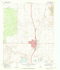
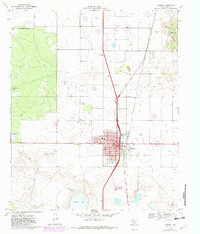
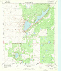
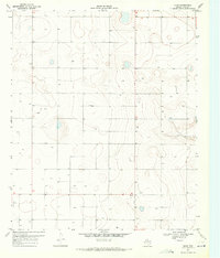
Tahoka serves as the central hub of this South Plains landscape, where the street grid is clearly defined by routes like North Fifth St and Lockwood St. The town's connection to broader commerce is anchored by the Atchison Topeka and Santa Fe railroad, which runs through the eastern edge of the settlement. The surrounding terrain is marked by notable depressions containing Tahoka Lake to the northeast and Guthrie Lake to the south, providing a stark contrast to the surrounding agricultural plains.
Find a feature on this map
19 named features on this map. Tap any name to fly to it.
Don’t see what you’re looking for? This feature index may not catch every label — zoom into the map to look around manually.
Map Details
Editions of this 1969 Tahoka Map
2 editions found
Other maps of this area

1954 · Lubbock
USGS Topo · 1:250,000
1957 · New Home
USGS Topo · 1:62,500
1965 · Wilson
USGS Topo · 1:24,000
1969 · Skeen Lake
USGS Topo · 1:24,000
1969 · Tahoka SW
USGS Topo · 1:24,000
1969 · Double Lakes
USGS Topo · 1:24,000
1970 · New Lynn
USGS Topo · 1:24,000
1970 · Draw
USGS Topo · 1:24,000
1976 · New Home SE
USGS Topo · 1:24,000
1976 · New Home SW
USGS Topo · 1:24,000