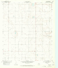
1970 Map of Draw
USGS Topo · Published 1971About this map
The tiny settlement of Draw anchors this 1970 study of the Llano Estacado landscape in Lynn County. Located south of the central West Texas cotton belt, the terrain is defined by its subtle depressions and high plains topography, where water management is paramount. Numerous Well and Wells locations are scattered across the grid, reflecting the intensive subsurface irrigation required for agriculture in this semi-arid region. In the northern reaches, the map identifies the area of Pennington, while a single Substa in the south provides a clue to the utility infrastructure supporting the scattered farmsteads.
Find a feature on this map
5 named features on this map. Tap any name to fly to it.
Don’t see what you’re looking for? This feature index may not catch every label — zoom into the map to look around manually.
Map Details
Editions of this 1970 Draw Map
This is the sole edition of this map. No revisions or reprints were ever made.
Other maps of this area

1954 · Lubbock
USGS Topo · 1:250,000

1954 · Big Spring
USGS Topo · 1:250,000

1958 · Big Spring
USGS Topo · 1:250,000

1969 · Skeen Lake
USGS Topo · 1:24,000

1969 · O'Donnell
USGS Topo · 1:24,000

1969 · Tahoka
USGS Topo · 1:24,000

1969 · Indian Canyon NE
USGS Topo · 1:24,000

1969 · Grassland SE
USGS Topo · 1:24,000

1970 · New Lynn
USGS Topo · 1:24,000
1970 · Indian Canyon NW
USGS Topo · 1:24,000