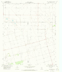
1970 Map of Indian Canyon NW
USGS Topo · Published 1971About this map
Plain View Cem and the nearby community of Plains anchor this 1970 landscape where the High Plains of West Texas meet at a complex junction of three counties. This survey reveals a terrain defined by subtle depressions and numerous water wells, highlighting the critical role of groundwater for the ranching and farming operations scattered across the Llano Estacado. The intersection of Lynn, Dawson, and Borden counties is clearly delineated, alongside local landmarks such as Berry Flat Ch and the location of Huff. The map provides a precise look at the rural infrastructure of the era, from the network of unimproved roads and light-duty highways to a specific Gravel Pit used for local development. This data-rich topographic study serves as a clear record of the settlement patterns and land use in a region where small rural centers like Plains served as vital hubs for the surrounding high plains community.
Find a feature on this map
11 named features on this map. Tap any name to fly to it.
Don’t see what you’re looking for? This feature index may not catch every label — zoom into the map to look around manually.
Map Details
Editions of this 1970 Indian Canyon NW Map
This is the sole edition of this map. No revisions or reprints were ever made.
Other maps of this area

1954 · Lubbock
USGS Topo · 1:250,000

1954 · Big Spring
USGS Topo · 1:250,000

1958 · Big Spring
USGS Topo · 1:250,000

1968 · Hancock
USGS Topo · 1:24,000

1969 · Skeen Lake
USGS Topo · 1:24,000

1969 · O'Donnell
USGS Topo · 1:24,000

1969 · Indian Canyon NE
USGS Topo · 1:24,000

1969 · Indian Canyon
USGS Topo · 1:24,000

1969 · Grassland SE
USGS Topo · 1:24,000

1969 · Holloway Canyon
USGS Topo · 1:24,000