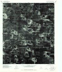
1976 Map of New Home SW
USGS Topo · Published 1978About this map
New Home and Petty stand as the primary focal points in this 1976 orthophotograph of the High Plains in Lynn County. Unlike traditional topographic maps, this orthophotoquad provides a direct visual record of the South Plains landscape, revealing the intricate patterns of center-pivot irrigation and the distinct playa lakes that dot the Llano Estacado. The stark, rectilinear grid of county roads defines the agricultural parcels, punctuated by the concentrated structures of New Home. The imagery captures the state of Texas cotton country during the mid-1970s, showing the precise footprints of farmsteads and rural infrastructure that shaped this portion of the Panhandle region before later decades of agricultural consolidation.
Find a feature on this map
2 named features on this map. Tap any name to fly to it.
Don’t see what you’re looking for? This feature index may not catch every label — zoom into the map to look around manually.
Map Details
Editions of this 1976 New Home SW Map
2 editions found
Other maps of this area

1954 · Lubbock
USGS Topo · 1:250,000

1954 · Brownfield
USGS Topo · 1:250,000

1957 · New Home
USGS Topo · 1:62,500

1957 · Meadow
USGS Topo · 1:62,500

1958 · Brownfield
USGS Topo · 1:250,000

1962 · Brownfield
USGS Topo · 1:250,000

1969 · Mound Lake
USGS Topo · 1:24,000

1969 · Tahoka
USGS Topo · 1:24,000

1969 · Double Lakes
USGS Topo · 1:24,000

1976 · New Home NW
USGS Topo · 1:24,000