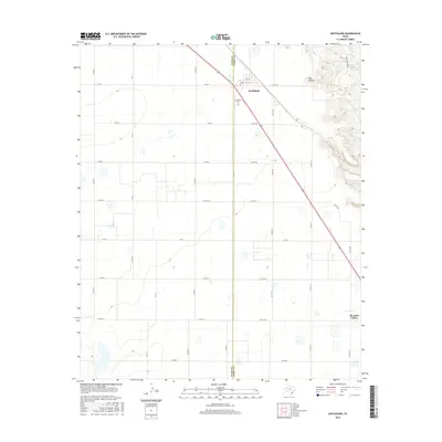
2016 Map of Southland
USGS Topo · Published 2016About this map
Southland serves as the primary hub in this West Texas landscape, positioned at the intersection of a sprawling grid of rural county roads. The settlement is anchored by local landmarks such as Resthaven Cem, which provides a focal point for genealogical interest in the area. The terrain transitions from the structured agricultural layout of the High Plains into the more varied topography of the Caprock Escarpment to the east. This shift is marked by the presence of Red Hollow and the drainage systems of N Dokegood Cr and S Dokegood Cr. To the southeast, the small community of Pleasant Valley appears near the county line, while the northern edge of the map features Sandy Creek Lake. The layout of the region reflects a deeply established cattle and cotton economy, where transportation is defined by long, straight stretches like FM 211 and the diagonal route of US Highway 84.
Find a feature on this map
34 named features on this map. Tap any name to fly to it.
Don’t see what you’re looking for? This feature index may not catch every label — zoom into the map to look around manually.
Map Details
Editions of this 2016 Southland Map
This is the sole edition of this map. No revisions or reprints were ever made.
Other maps of this area

1954 · Lubbock
USGS Topo · 1:250,000

1965 · Slaton
USGS Topo · 1:24,000

1965 · Southland
USGS Topo · 1:24,000

1965 · Wilson
USGS Topo · 1:24,000

1965 · Slaton NE
USGS Topo · 1:24,000

1966 · Cap Rock
USGS Topo · 1:24,000

1968 · South Dokegood Creek
USGS Topo · 1:24,000

1969 · Post West
USGS Topo · 1:24,000

1970 · New Lynn
USGS Topo · 1:24,000

1970 · Grassland
USGS Topo · 1:24,000