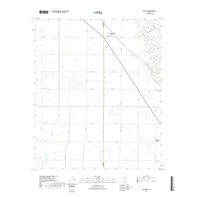
2019 Map of Southland
USGS Topo · Published 2019About this map
The boundary between Lynn and Garza counties runs through this portion of the Texas South Plains, where the flat agricultural tableland begins to drop into the breaks of the Llano Estacado. The settlement of Southland serves as a local hub near the northwestern corner, situated along a prominent transportation corridor that includes a major highway and 7th St. Further south, the community of Pleasant Valley sits near the eastern edge of the map, illustrating the dispersed settlement pattern typical of this ranching and farming region.
Find a feature on this map
31 named features on this map. Tap any name to fly to it.
Don’t see what you’re looking for? This feature index may not catch every label — zoom into the map to look around manually.
Map Details
Editions of this 2019 Southland Map
This is the sole edition of this map. No revisions or reprints were ever made.
Other maps of this area

1954 · Lubbock
USGS Topo · 1:250,000

1965 · Slaton
USGS Topo · 1:24,000

1965 · Southland
USGS Topo · 1:24,000

1965 · Wilson
USGS Topo · 1:24,000

1965 · Slaton NE
USGS Topo · 1:24,000

1966 · Cap Rock
USGS Topo · 1:24,000

1968 · South Dokegood Creek
USGS Topo · 1:24,000

1969 · Post West
USGS Topo · 1:24,000

1970 · New Lynn
USGS Topo · 1:24,000

1970 · Grassland
USGS Topo · 1:24,000