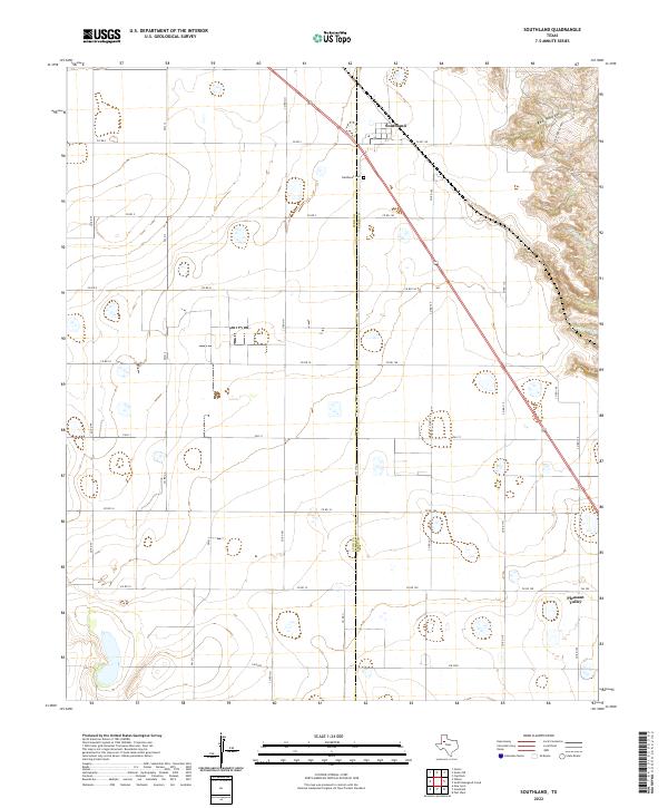
2022 Map of Southland
USGS Topo · Published 2022About this map
The community of Southland sits at the intersection of the Lynn and Garza county line, serving as a focal point for this agricultural landscape on the High Plains. The settlement is anchored by the Resthaven Cem and a network of rural routes including Co RD 3 and Co RD 130. To the southeast, the small settlement of Pleasant Valley marks another point of habitation amidst the sprawling grid of section roads. The terrain is largely defined by the dramatic break in topography at the eastern edge, where the land drops away into the erosion-carved drainage of Red Hollow. This transition is further marked by the seasonal headwaters of N Dokegood Cr and S Dokegood Cr, which provide a sharp contrast to the flat, cultivated fields that dominate the majority of the map.
Find a feature on this map
23 named features on this map. Tap any name to fly to it.
Don’t see what you’re looking for? This feature index may not catch every label — zoom into the map to look around manually.
Map Details
Editions of this 2022 Southland Map
This is the sole edition of this map. No revisions or reprints were ever made.
Other maps of this area

1954 · Lubbock
USGS Topo · 1:250,000

1965 · Slaton
USGS Topo · 1:24,000

1965 · Southland
USGS Topo · 1:24,000

1965 · Wilson
USGS Topo · 1:24,000

1965 · Slaton NE
USGS Topo · 1:24,000

1966 · Cap Rock
USGS Topo · 1:24,000

1968 · South Dokegood Creek
USGS Topo · 1:24,000

1969 · Post West
USGS Topo · 1:24,000

1970 · New Lynn
USGS Topo · 1:24,000

1970 · Grassland
USGS Topo · 1:24,000