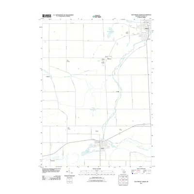
2011 Map of Southwest Albion
USGS Topo · Published 2011About this map
Albion and Homer anchor the north and south of this 2011 survey, connected by a network of rural roads and the winding South Branch Kalamazoo River. The landscape is notably defined by its many historic burial grounds, including the Cook's Prairie Cemetery and East Eckford Cemetery, which suggest the deep-rooted agricultural settlement of Calhoun County. In the north, the Kalamazoo River flows through the urban grid of Albion near Riverside Cemetery, while to the south, Homer Lake and the Saint Joseph River border the village of Clarendon. This topographical study captures the transition from small-town centers to a strictly partitioned rural grid, marked by legacy landmarks like Midway Airport and Camp Tanawida. The prevalence of small water bodies like Spectacle Lake and Kesler Lake highlights the glacial geography that shaped the local drainage patterns, including Wilder Creek and Andrus Drain.
Find a feature on this map
57 named features on this map. Tap any name to fly to it.
Don’t see what you’re looking for? This feature index may not catch every label — zoom into the map to look around manually.
Map Details
Editions of this 2011 Southwest Albion Map
This is the sole edition of this map. No revisions or reprints were ever made.
Other maps of this area

1919 · Springport
USGS Topo · 1:62,500

1921 · Springport
USGS Topo · 1:62,500

1921 · Marshall
USGS Topo · 1:62,500

1923 · Marshall
USGS Topo · 1:62,500

1943 · Marshall
USGS Topo · 1:62,500

1948 · Spring Arbor
USGS Topo · 1:62,500

1948 · Homer
USGS Topo · 1:62,500

1949 · Homer
USGS Topo · 1:62,500

1949 · Spring Arbor
USGS Topo · 1:62,500

1958 · Grand Rapids
USGS Topo · 1:250,000