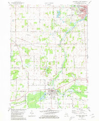
1980 Map of Southwest Albion
USGS Topo · Published 1980About this map
The South Branch Kalamazoo River winds through this 1980 landscape, connecting the industrial and residential centers of Albion and Homer. The map documents a predominantly agricultural region defined by its grid of mile-roads and the presence of the Conrail railroad lines that historically supported these rural communities. To the west, the settlement of Eckford sits near Wilder Creek, while the small cluster at Clarendon marks the southwestern reaches of the survey.
Find a feature on this map
62 named features on this map. Tap any name to fly to it.
Don’t see what you’re looking for? This feature index may not catch every label — zoom into the map to look around manually.
Map Details
Editions of this 1980 Southwest Albion Map
This is the sole edition of this map. No revisions or reprints were ever made.
Other maps of this area

1919 · Springport
USGS Topo · 1:62,500

1921 · Springport
USGS Topo · 1:62,500

1921 · Marshall
USGS Topo · 1:62,500

1923 · Marshall
USGS Topo · 1:62,500

1943 · Marshall
USGS Topo · 1:62,500

1948 · Spring Arbor
USGS Topo · 1:62,500

1948 · Homer
USGS Topo · 1:62,500

1949 · Homer
USGS Topo · 1:62,500

1949 · Spring Arbor
USGS Topo · 1:62,500

1958 · Grand Rapids
USGS Topo · 1:250,000