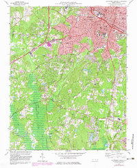
1973 Map of Southwest Durham
USGS Topo · Published 1983About this map
Duke University and the expanding south side of Durham define the landscape of the early 1970s, a period of significant institutional and residential growth. This topographic record documents the city's southward reach toward Lowes Grove and the small community of Blands, anchored by academic centers like North Carolina Central University and Durham College. The map captures a transition in water management and land use, with the rising waters of B Everett Jordan Lake appearing in the southern reaches, fed by New Hope Creek and Northeast Creek.
Find a feature on this map
72 named features on this map. Tap any name to fly to it.
Don’t see what you’re looking for? This feature index may not catch every label — zoom into the map to look around manually.
Map Details
Editions of this 1973 Southwest Durham Map
4 editions found
Other maps of this area

1943 · Durham South
USGS Topo · 1:62,500

1946 · Chapel Hill
USGS Topo · 1:24,000

1947 · Chapel Hill
USGS Topo · 1:31,680

1951 · Farrington
USGS Topo · 1:24,000

1951 · Durham South
USGS Topo · 1:62,500

1951 · Durham North
USGS Topo · 1:62,500

1953 · Raleigh
USGS Topo · 1:250,000

1953 · Greensboro
USGS Topo · 1:250,000

1954 · Greensboro
USGS Topo · 1:250,000

1954 · Raleigh
USGS Topo · 1:250,000