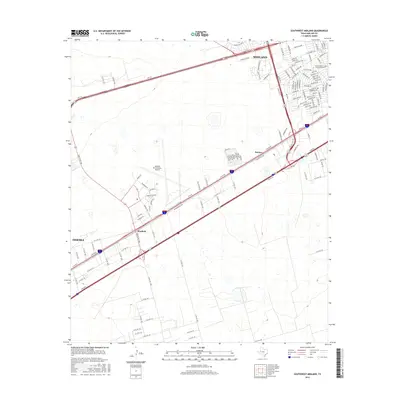
2016 Map of Southwest Midland
USGS Topo · Published 2016About this map
Midland International Airport dominates the central landscape of this 2016 survey, serving as a pivot point between two major Permian Basin hubs. To the northeast, the outskirts of Midland feature an organized grid of residential streets like Crockett Ave and Thomason Dr, alongside specialized institutions such as the Southeastern Career Institute-Midland. The southwestern portion of the sheet captures the edge of Odessa, linked by a heavy transit corridor that includes Hwy 191 and W Hwy 80. Between these urban centers lie the smaller settlements of Warfield and Bounce, illustrating the industrial and residential infill that characterizes the corridor. The terrain remains largely open outside the immediate influence of the highways, defined by a sparse network of county roads that service the energy-rich plains of West Texas.
Find a feature on this map
127 named features on this map. Tap any name to fly to it.
Don’t see what you’re looking for? This feature index may not catch every label — zoom into the map to look around manually.
Map Details
Editions of this 2016 Southwest Midland Map
This is the sole edition of this map. No revisions or reprints were ever made.
Other maps of this area

1954 · Hobbs
USGS Topo · 1:250,000

1954 · Pecos
USGS Topo · 1:250,000

1957 · Pecos
USGS Topo · 1:250,000

1958 · Hobbs
USGS Topo · 1:250,000

1964 · Bryant Ranch
USGS Topo · 1:24,000

1964 · Odessa NE
USGS Topo · 1:24,000

1964 · Odessa SE
USGS Topo · 1:24,000

1964 · Parks
USGS Topo · 1:24,000

1965 · Southeast Midland
USGS Topo · 1:24,000

1965 · Southwest Midland
USGS Topo · 1:24,000