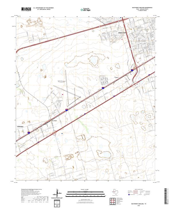
2022 Map of Southwest Midland
USGS Topo · Published 2022About this map
The Midland International Air and Space Port anchors this West Texas corridor, situated between the expanding urban reach of Midland and Odessa. This 2022 survey captures the region's modern infrastructure and industrial footprint, characterized by the dense network of roadways like Patriot Pkwy and S Loop 250 W that support the petroleum-rich Permian Basin. Residential growth in the northwest is evident through new developments near Nolan Ryan Dr and Legends Blvd, reflecting the steady suburbanization of the high plains.
Find a feature on this map
147 named features on this map. Tap any name to fly to it.
Don’t see what you’re looking for? This feature index may not catch every label — zoom into the map to look around manually.
Map Details
Editions of this 2022 Southwest Midland Map
This is the sole edition of this map. No revisions or reprints were ever made.
Other maps of this area

1954 · Hobbs
USGS Topo · 1:250,000

1954 · Pecos
USGS Topo · 1:250,000

1957 · Pecos
USGS Topo · 1:250,000

1958 · Hobbs
USGS Topo · 1:250,000

1964 · Bryant Ranch
USGS Topo · 1:24,000

1964 · Odessa NE
USGS Topo · 1:24,000

1964 · Odessa SE
USGS Topo · 1:24,000

1964 · Parks
USGS Topo · 1:24,000

1965 · Southeast Midland
USGS Topo · 1:24,000

1965 · Southwest Midland
USGS Topo · 1:24,000