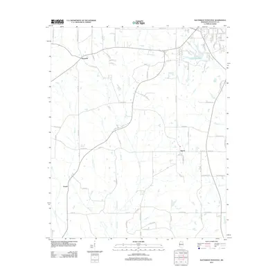
2012 Map of Southwest Pontotoc
USGS Topo · Published 2012About this map
Skuna River and its tributaries, including Little Skuna Cr and Funny Cr, dominate the drainage patterns of this southern Pontotoc County landscape. The settlement of Algoma serves as a central hub, while Springville and Pannell anchor the western reaches. To the northeast, the outskirts of Pontotoc are represented by the presence of Pontotoc Lake and a dense residential grid featuring Woodland St and Highland Dr.
Find a feature on this map
92 named features on this map. Tap any name to fly to it.
Don’t see what you’re looking for? This feature index may not catch every label — zoom into the map to look around manually.
Map Details
Editions of this 2012 Southwest Pontotoc Map
This is the sole edition of this map. No revisions or reprints were ever made.
Other maps of this area

1949 · New Albany
USGS Topo · 1:62,500

1951 · New Albany
USGS Topo · 1:62,500

1955 · Sherman
USGS Topo · 1:62,500

1956 · Tupelo
USGS Topo · 1:250,000

1958 · Tupelo
USGS Topo · 1:250,000

1966 · Troy NW
USGS Topo · 1:24,000

1966 · Troy
USGS Topo · 1:24,000

1972 · Houlka
USGS Topo · 1:24,000

1972 · Robbs
USGS Topo · 1:24,000

1972 · Randolph
USGS Topo · 1:24,000