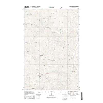
2013 Map of Spades Mountain
USGS Topo · Published 2013About this map
Spades Mtn and Chilco Mtn dominate this high-elevation portion of the Coeur d'Alene National Forest in northern Idaho. The landscape is defined by a dense network of drainages including the Little N Fork Coeur d'Alene River and Burnt Cabin Cr, which carve through deep features like Hells Canyon. Access is provided by a series of Forest Service routes, such as Nat For Dev Rd 406 and Huckleberry Mtn Rd, reflecting the management of these timber and recreational lands. Evidence of the region's prospecting history appears along Lost Mines Rd near Windy Ridge. Significant topography for navigation and survey is marked at Sage Creek Saddle and Hudlow Saddle, while Hudlow Camp serves as a localized landmark for those traversing the ridges between Buckles Mtn and Badger Mtn.
Find a feature on this map
61 named features on this map. Tap any name to fly to it.
Don’t see what you’re looking for? This feature index may not catch every label — zoom into the map to look around manually.
Map Details
Editions of this 2013 Spades Mountain Map
This is the sole edition of this map. No revisions or reprints were ever made.
Other maps of this area

1903 · Rathdrum
USGS Topo · 1:125,000

1909 · Cataldo
USGS Topo · 1:125,000

1911 · Cataldo
USGS Topo · 1:125,000

1955 · Spokane
USGS Topo · 1:250,000

1957 · Kingston
USGS Topo · 1:62,500

1957 · Lane
USGS Topo · 1:62,500

1958 · Spokane
USGS Topo · 1:250,000

1961 · Bayview
USGS Topo · 1:24,000
1961 · Lakeview
USGS Topo · 1:24,000

1961 · Athol
USGS Topo · 1:24,000