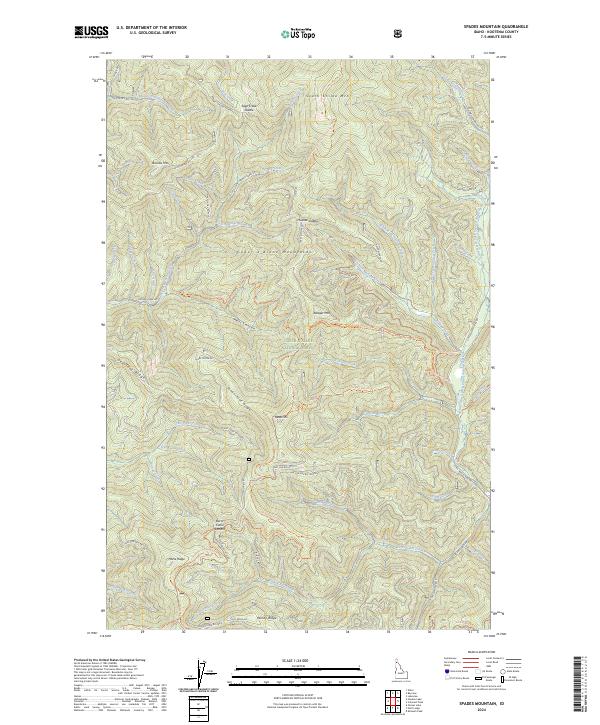
2024 Map of Spades Mountain
USGS Topo · Published 2024About this map
Coeur d'Alene National Forest dominates this mountain landscape, defined by high ridges and the complex drainage of the Little North Fork Coeur d'Alene River. The area is characterized by a dense network of forest development roads and primitive trails that crisscross significant peaks like Spades Mtn and South Chilco Mtn. Transportation routes such as Hayden Creek Rd and Lakes Divide Rd follow the contours of the Coeur d'Alene Mountains, providing access to remote high points like Burnt Cabin Summit. The presence of Lost Mines Rd near Windy Ridge suggests the historical prospecting and extraction activity that once took place in these northern Idaho uplands. Hikers and recreationalists can trace the South Chilco Mtn National Recreation Trl or explore more isolated paths like Hells Canyon Trl through the deep drainage of Hells Canyon.
Find a feature on this map
72 named features on this map. Tap any name to fly to it.
Don’t see what you’re looking for? This feature index may not catch every label — zoom into the map to look around manually.
Map Details
Editions of this 2024 Spades Mountain Map
This is the sole edition of this map. No revisions or reprints were ever made.
Other maps of this area

1903 · Rathdrum
USGS Topo · 1:125,000

1909 · Cataldo
USGS Topo · 1:125,000

1911 · Cataldo
USGS Topo · 1:125,000

1955 · Spokane
USGS Topo · 1:250,000

1957 · Kingston
USGS Topo · 1:62,500

1957 · Lane
USGS Topo · 1:62,500

1958 · Spokane
USGS Topo · 1:250,000

1961 · Bayview
USGS Topo · 1:24,000
1961 · Lakeview
USGS Topo · 1:24,000

1961 · Athol
USGS Topo · 1:24,000