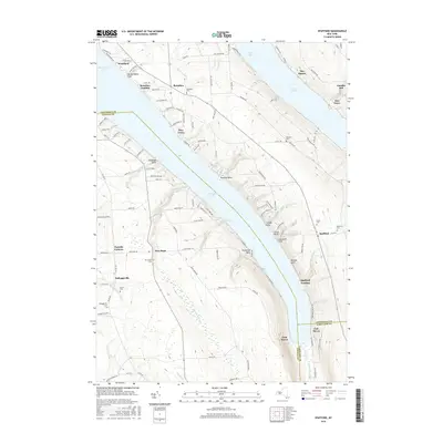
2016 Map of Spafford
USGS Topo · Published 2016About this map
Skaneateles Lake and the northwestern corner of Otisco Lake define this Finger Lakes landscape, where steep glacial valleys create a series of distinctive landforms. Prominent points like Tenmile Point and Threemile Point reach into the deep waters of Skaneateles, while the eastern shore is marked by deep incisions such as Barber Gulf and Randall Gulf. The settlement pattern reflects the area's maritime and agricultural history, with lakeside communities like Borodino Landing and Spafford Landing serving as traditional connection points between the water and the upland villages.
Find a feature on this map
125 named features on this map. Tap any name to fly to it.
Don’t see what you’re looking for? This feature index may not catch every label — zoom into the map to look around manually.
Map Details
Editions of this 2016 Spafford Map
This is the sole edition of this map. No revisions or reprints were ever made.
Other maps of this area

1898 · Moravia
USGS Topo · 1:62,500

1899 · Skaneateles
USGS Topo · 1:62,500

1900 · Tully
USGS Topo · 1:62,500

1902 · Skaneateles
USGS Topo · 1:62,500

1902 · Moravia
USGS Topo · 1:62,500

1903 · Cortland
USGS Topo · 1:62,500

1943 · South Onondaga
USGS Topo · 1:31,680

1943 · Moravia
USGS Topo · 1:31,680

1943 · Spafford
USGS Topo · 1:31,680

1943 · Owasco
USGS Topo · 1:31,680