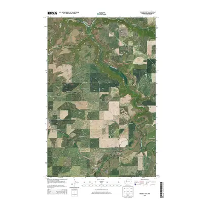
2014 Map of Spangle East
USGS Topo · Published 2014About this map
Spangle stands at the western edge of this 2014 survey, where the rolling agricultural uplands of Spokane County transition into the carved drainages of Hangman Creek. The landscape is defined by the deep incisions of Courtney Canyon and the broader expanse of Hangman Valley, reflecting the complex erosional history of the Palouse region. A dense network of rural roads, including S Old State Road 195 and E Spangle Waverly Rd, connects isolated farmsteads across the township grids of T23N and T22N.
Find a feature on this map
39 named features on this map. Tap any name to fly to it.
Don’t see what you’re looking for? This feature index may not catch every label — zoom into the map to look around manually.
Map Details
Editions of this 2014 Spangle East Map
This is the sole edition of this map. No revisions or reprints were ever made.
Other maps of this area

1901 · Spokane
USGS Topo · 1:125,000

1903 · Oakesdale
USGS Topo · 1:125,000

1905 · Oakesdale
USGS Topo · 1:125,000

1949 · Greenacres
USGS Topo · 1:62,500

1950 · Spokane SE
USGS Topo · 1:24,000

1950 · Spokane SW
USGS Topo · 1:24,000

1950 · Spokane
USGS Topo · 1:62,500

1951 · Greenacres
USGS Topo · 1:62,500

1954 · Spangle
USGS Topo · 1:62,500

1954 · Fairfield
USGS Topo · 1:62,500