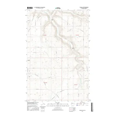
2017 Map of Spangle East
USGS Topo · Published 2017About this map
Spangle sits at the western edge of this 2017 survey, where the rolling agricultural uplands of Spokane County transition toward the riparian corridor of Hangman Creek. The landscape is defined by a dense network of local roads such as E Spangle Waverly Rd and S Old St Route 195, tracing a pattern of rural land use that persists south of the city. Significant topographic features like Courtney Canyon and the Hangman Valley break the high-plateau terrain, channeling local drainage through Spangle Cr and Rock Cr. This modern data illustrates the intersection of historical township boundaries, including t23n r43e and t23n r44e, with contemporary infrastructure like Spangle Field. The map provides a clear record of property access and land divisions, from the northern Tiger Lilly Ln down to E Davis Rd in the south.
Find a feature on this map
42 named features on this map. Tap any name to fly to it.
Don’t see what you’re looking for? This feature index may not catch every label — zoom into the map to look around manually.
Map Details
Editions of this 2017 Spangle East Map
This is the sole edition of this map. No revisions or reprints were ever made.
Other maps of this area

1901 · Spokane
USGS Topo · 1:125,000

1903 · Oakesdale
USGS Topo · 1:125,000

1905 · Oakesdale
USGS Topo · 1:125,000

1949 · Greenacres
USGS Topo · 1:62,500

1950 · Spokane SE
USGS Topo · 1:24,000

1950 · Spokane SW
USGS Topo · 1:24,000

1950 · Spokane
USGS Topo · 1:62,500

1951 · Greenacres
USGS Topo · 1:62,500

1954 · Spangle
USGS Topo · 1:62,500

1954 · Fairfield
USGS Topo · 1:62,500