
1981 Map of Spangle East
USGS Topo · Published 1992About this map
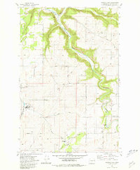
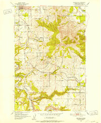
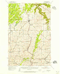
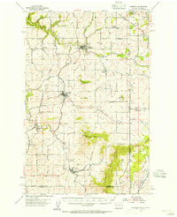
Hangman Creek Valley dominates this landscape south of Spokane, where the dramatic incision of Hangman Creek and its tributaries creates a sharp contrast between the flat upland agricultural plateaus and the deep drainage basins. The settlement of Spangle sits on the western edge of the sheet, serving as a hub for the surrounding rural section lines. Much of the local infrastructure is dedicated to education and community history, evidenced by the presence of Upper Columbia Academy and the Liberty High Sch further south.
Find a feature on this map
32 named features on this map. Tap any name to fly to it.
Don’t see what you’re looking for? This feature index may not catch every label — zoom into the map to look around manually.
Map Details
Editions of this 1981 Spangle East Map
2 editions found
Other maps of this area

1901 · Spokane
USGS Topo · 1:125,000

1903 · Oakesdale
USGS Topo · 1:125,000

1905 · Oakesdale
USGS Topo · 1:125,000

1949 · Greenacres
USGS Topo · 1:62,500
1950 · Spokane SE
USGS Topo · 1:24,000

1950 · Spokane SW
USGS Topo · 1:24,000

1950 · Spokane
USGS Topo · 1:62,500

1951 · Greenacres
USGS Topo · 1:62,500
1954 · Spangle
USGS Topo · 1:62,500
1954 · Fairfield
USGS Topo · 1:62,500