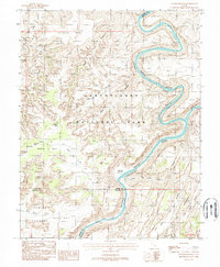
1988 Map of Spanish Bottom
USGS Topo · Published 1988About this map
Canyonlands National Park dominates this 1980s landscape at the confluence of the Green River and the Colorado River. This remote interior of the Colorado Plateau reveals a complex geologic story where Stillwater Canyon gives way to the turbulent Cataract Canyon just below Spanish Bottom. The map provides a remarkable level of detail for wilderness navigation, noting natural arches like Muffin Arch and Beehive Arch, alongside striking vertical formations such as the Chocolate Drops and Chimney Rock.
Find a feature on this map
36 named features on this map. Tap any name to fly to it.
Don’t see what you’re looking for? This feature index may not catch every label — zoom into the map to look around manually.
Map Details
Editions of this 1988 Spanish Bottom Map
This is the sole edition of this map. No revisions or reprints were ever made.
Other maps of this area

1885 · San Rafael
USGS Topo · 1:250,000

1885 · La Sal
USGS Topo · 1:250,000

1951 · Upheaval Dome
USGS Topo · 1:62,500

1952 · Carlisle 2 SE
USGS Topo · 1:24,000

1952 · Carlisle 2 SW
USGS Topo · 1:24,000

1953 · Carlisle 3 NW
USGS Topo · 1:24,000

1953 · Orange Cliffs 1 SE
USGS Topo · 1:24,000

1953 · Orange Cliffs 4 NE
USGS Topo · 1:24,000

1953 · The Spur
USGS Topo · 1:62,500

1953 · The Needles
USGS Topo · 1:62,500