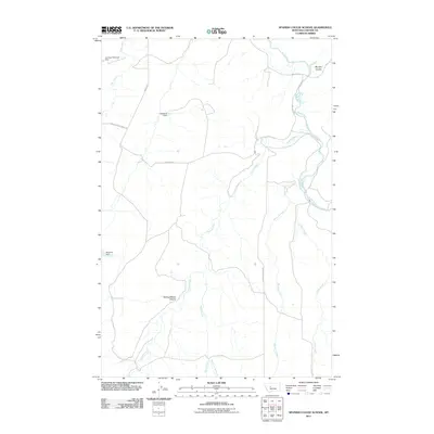
2011 Map of Spanish Coulee School
USGS Topo · Published 2011About this map
The Smith River winds through the eastern reaches of this Cascade County landscape, serving as the primary drainage for a network of coulees and creeks. This 2011 survey illustrates a ranching and water-management system defined by several named impoundments, including Mesaros Dam, Spaniard Dam, and Leveque Reservoir Dam located on West Fork Flat Creek. These water features, alongside Spring Creek and Hound Creek, highlight the vital role of irrigation and livestock watering in this Montana region.
Find a feature on this map
17 named features on this map. Tap any name to fly to it.
Don’t see what you’re looking for? This feature index may not catch every label — zoom into the map to look around manually.
Map Details
Editions of this 2011 Spanish Coulee School Map
This is the sole edition of this map. No revisions or reprints were ever made.
Other maps of this area

1886 · Great Falls
USGS Topo · 1:250,000

1949 · Cascade
USGS Topo · 1:62,500

1951 · Cascade
USGS Topo · 1:62,500

1954 · Great Falls
USGS Topo · 1:250,000

1955 · Gore Hill
USGS Topo · 1:62,500

1957 · Great Falls
USGS Topo · 1:250,000

1961 · Schrammeck Lake
USGS Topo · 1:24,000

1961 · Dana Ranch
USGS Topo · 1:24,000

1965 · Eden
USGS Topo · 1:24,000
1965 · Truly
USGS Topo · 1:24,000