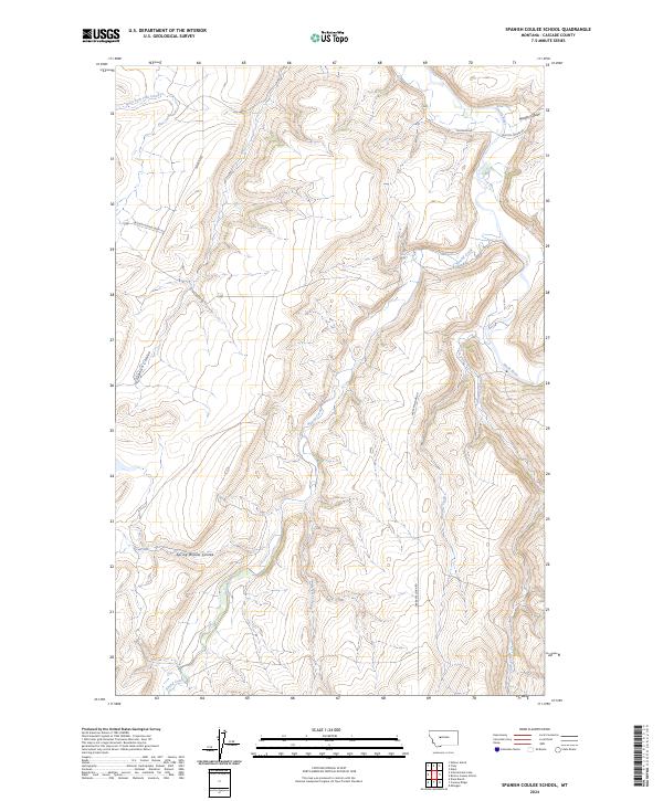
2024 Map of Spanish Coulee School
USGS Topo · Published 2024About this map
Hound Creek and the Smith River carve through this Montana landscape, defining a network of drainages and coulees southeast of Cascade. The map reveals a rural infrastructure of high-plains ranch roads, including Millegan Rd and Boston Coulee Rd, which navigate the elevation changes between Murphy Coulee and Spanish Coulee. This modern survey documents the contemporary hydrography of the region, from the seasonal flows of Spring Willow Coulee to the permanent waters of Mullens Creek and Clark Creek. The layout of these waterways and roads reflects the enduring patterns of Montana's open-range topography, where access is dictated by the deeply etched creek beds and the steep ridges that separate them.
Find a feature on this map
19 named features on this map. Tap any name to fly to it.
Don’t see what you’re looking for? This feature index may not catch every label — zoom into the map to look around manually.
Map Details
Editions of this 2024 Spanish Coulee School Map
This is the sole edition of this map. No revisions or reprints were ever made.
Other maps of this area

1886 · Great Falls
USGS Topo · 1:250,000

1949 · Cascade
USGS Topo · 1:62,500

1951 · Cascade
USGS Topo · 1:62,500

1954 · Great Falls
USGS Topo · 1:250,000

1955 · Gore Hill
USGS Topo · 1:62,500

1957 · Great Falls
USGS Topo · 1:250,000

1961 · Schrammeck Lake
USGS Topo · 1:24,000

1961 · Dana Ranch
USGS Topo · 1:24,000

1965 · Eden
USGS Topo · 1:24,000
1965 · Truly
USGS Topo · 1:24,000