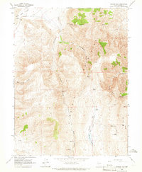
1964 Map of Spanish Flat
USGS Topo · Published 1966About this map
The Virginia Mountains dominate this 1960s landscape, where complex ridges and drainages reveal a reliance on scarce water sources in the high desert of Washoe County. This survey shows a network of remote water points essential for livestock or travelers, including Salt Cabin Spring, Lower Scott Springs, and Upper Scott Spring. The topography transitions from the high peaks down toward Honey Lake Valley in the northwest, while the southeastern portion is defined by the seasonal flow of Dry Spanish Flat Creek and the Spanish Flat Reservoir. A series of naming conventions, such as Telephone Pole Canyon and Scott Pass, suggests a history of early utility lines and established high-altitude crossings. The map is crossed by numerous Jeep Trails, indicating a landscape accessed by miners or ranchers in the mid-20th century.
Find a feature on this map
26 named features on this map. Tap any name to fly to it.
Don’t see what you’re looking for? This feature index may not catch every label — zoom into the map to look around manually.
Map Details
Editions of this 1964 Spanish Flat Map
2 editions found
Other maps of this area

1886 · Granite Range
USGS Topo · 1:250,000

1891 · Reno
USGS Topo · 1:125,000

1893 · Reno
USGS Topo · 1:125,000

1894 · Granite Range
USGS Topo · 1:250,000

1955 · Lovelock
USGS Topo · 1:250,000

1957 · Sutcliffe
USGS Topo · 1:62,500

1957 · Dogskin Mountain
USGS Topo · 1:62,500

1957 · Reno
USGS Topo · 1:250,000

1959 · Lovelock
USGS Topo · 1:250,000

1959 · Reno
USGS Topo · 1:250,000