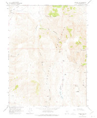
1964 Map of Spanish Flat
USGS Topo · Published 1975About this map
The Virginia Mountains dominate this arid landscape in northwestern Nevada, where seasonal water sources dictate the geography of human movement and settlement. Mapping in the mid-1960s shows a terrain defined by deep drainages like Telephone Pole Canyon and East Cottonwood Canyon, which funnel toward the Honey Lake Valley to the northwest. These corridors were likely essential for early ranching and travel, evidenced by the network of jeep trails and older paths labeled simply as Trail that connect various mountain passes.
Find a feature on this map
26 named features on this map. Tap any name to fly to it.
Don’t see what you’re looking for? This feature index may not catch every label — zoom into the map to look around manually.
Map Details
Editions of this 1964 Spanish Flat Map
2 editions found
Other maps of this area

1886 · Granite Range
USGS Topo · 1:250,000

1891 · Reno
USGS Topo · 1:125,000

1893 · Reno
USGS Topo · 1:125,000

1894 · Granite Range
USGS Topo · 1:250,000

1955 · Lovelock
USGS Topo · 1:250,000

1957 · Sutcliffe
USGS Topo · 1:62,500

1957 · Dogskin Mountain
USGS Topo · 1:62,500

1957 · Reno
USGS Topo · 1:250,000

1959 · Lovelock
USGS Topo · 1:250,000

1959 · Reno
USGS Topo · 1:250,000