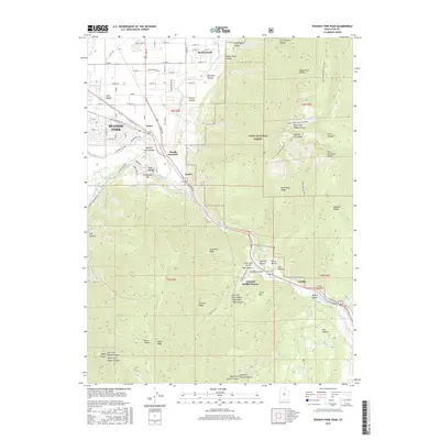
2017 Map of Spanish Fork Peak
USGS Topo · Published 2017About this map
Spanish Fork and Mapleton anchor the northwestern portion of this landscape, where the urban street grid meets the rising slopes of the Wasatch Range. The terrain is defined by deep incisions like Spanish Fork Canyon, which carries S State Rd through the mountains, connecting the valley floor to the interior highlands. Irrigation and water management are evident along the valley floor through a network of canals, including the El Bench Canal and Mill Race Canal. To the east, the Uinta National Forest encompasses massive vertical features such as Spanish Fork Peak and Wind Rock Ridge. Local history is visible in the smaller named settlements and junctions along the mountain base, including Moark Junction, Gomex, and the resort area at Castilla, known for Castilla Springs.
Find a feature on this map
88 named features on this map. Tap any name to fly to it.
Don’t see what you’re looking for? This feature index may not catch every label — zoom into the map to look around manually.
Map Details
Editions of this 2017 Spanish Fork Peak Map
This is the sole edition of this map. No revisions or reprints were ever made.
Other maps of this area

1885 · Salt Lake
USGS Topo · 1:250,000

1885 · Manti
USGS Topo · 1:250,000

1895 · Manti
USGS Topo · 1:250,000

1907 · Strawberry Valley
USGS Topo · 1:125,000

1909 · Strawberry Valley
USGS Topo · 1:125,000

1948 · Spanish Fork
USGS Topo · 1:24,000

1948 · Springville
USGS Topo · 1:24,000

1948 · Provo
USGS Topo · 1:24,000

1949 · Provo
USGS Topo · 1:62,500

1949 · Spanish Fork Peak
USGS Topo · 1:24,000