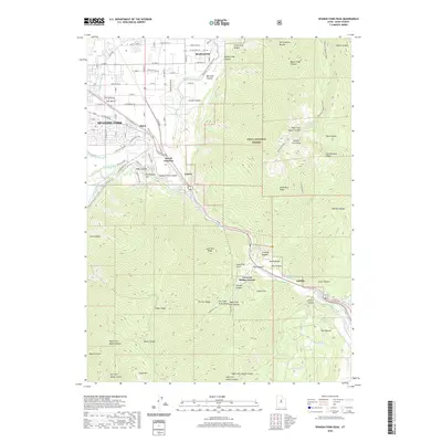
2020 Map of Spanish Fork Peak
USGS Topo · Published 2020About this map
Spanish Fork Peak dominates the eastern skyline of the Wasatch Range, towering over a landscape defined by the transition from the modern grid of Mapleton and Spanish Fork to the high elevations of the Uinta National Forest. The map documents a complex water management system crucial to this part of Utah, featuring the Mapleton-Lateral canal and the Mill-Race-Canal winding through the foothills. Along the corridor of Spanish Fork Canyon, smaller settlements and junctions such as Castilla, Gomex, and Moark Junction appear alongside topographic landmarks like Sterling Hollow and Covered Bridge Canyon. The geography reflects the region's reliance on canyon-fed water sources, with Castilla Springs and Gold Springs tucked into the slopes of North Bench.
Find a feature on this map
96 named features on this map. Tap any name to fly to it.
Don’t see what you’re looking for? This feature index may not catch every label — zoom into the map to look around manually.
Map Details
Editions of this 2020 Spanish Fork Peak Map
This is the sole edition of this map. No revisions or reprints were ever made.
Other maps of this area

1885 · Salt Lake
USGS Topo · 1:250,000

1885 · Manti
USGS Topo · 1:250,000

1895 · Manti
USGS Topo · 1:250,000

1907 · Strawberry Valley
USGS Topo · 1:125,000

1909 · Strawberry Valley
USGS Topo · 1:125,000

1948 · Spanish Fork
USGS Topo · 1:24,000

1948 · Springville
USGS Topo · 1:24,000

1948 · Provo
USGS Topo · 1:24,000

1949 · Provo
USGS Topo · 1:62,500

1949 · Spanish Fork Peak
USGS Topo · 1:24,000